
Heading West, Part 2: Utah & Arizona

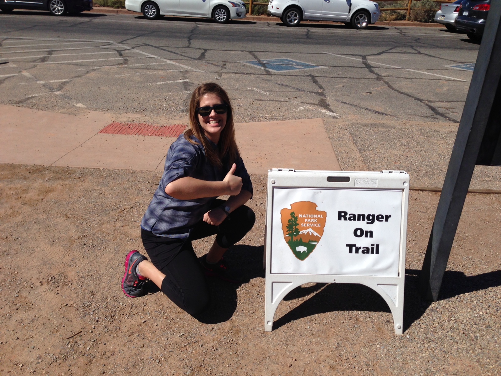
Monday through Thursday of our road trip was all about the National Parks! (Thank the stars we visited these parks the week before the government shutdown.) I think I visited more national parks this year than in my entire life haha. And now I’m a super excited advocate for visiting these parks! National and State Parks are perfect activities for road trips, and vacations in general. Each day of our road trip, my dad and I had a destination in mind and, aside from the entry fees, these are very inexpensive adventures. I am now more eager than ever to visit as many National and State Parks as possible, because I learned just how many amazing natural sites our country has to offer.

[If you are hopping aboard this Part 2 post and have not read Part 1, click here!]
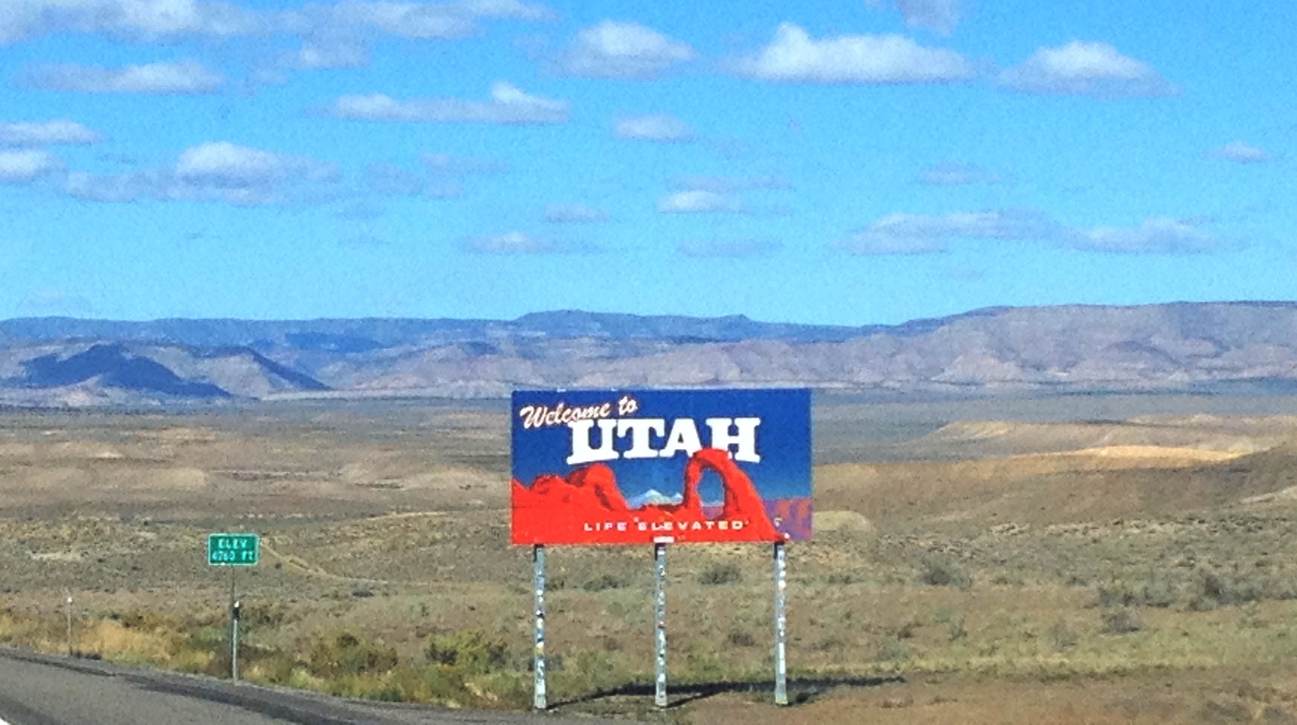
Crossing the border!
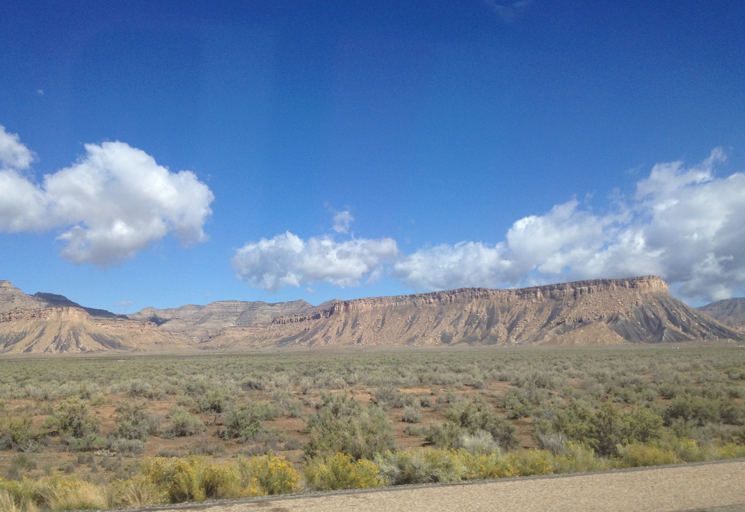
It’s a beautiful day for a drive through Utah.
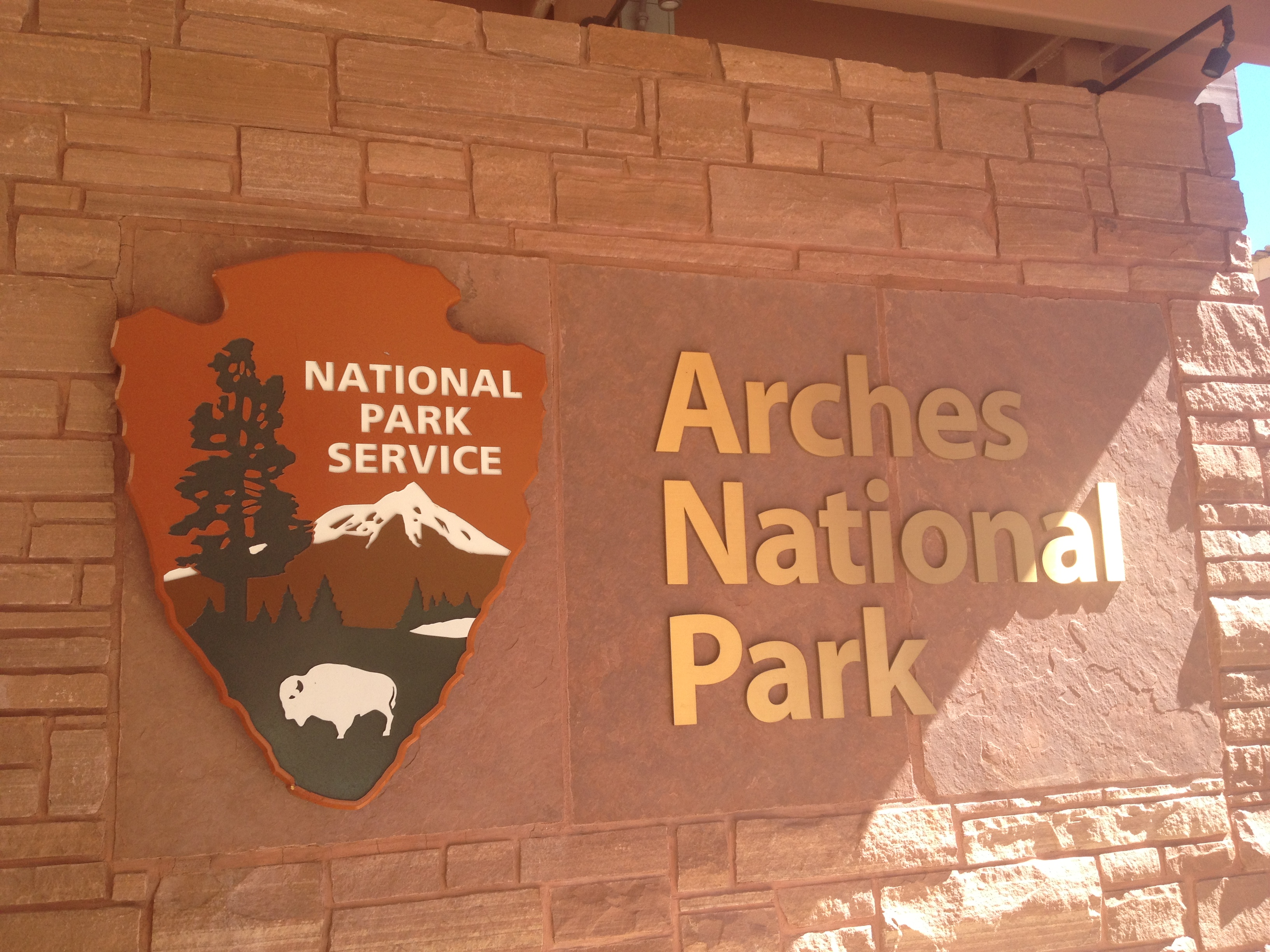
On Monday morning we departed Glenwood Springs and continued our road trip, heading west into Utah. My goal was to first visit Arches National Park and cross off “seeing the Delicate Arch” from my bucket list. Well as luck would have it, that was the ONE place in the park that was closed due to recent flooding. Of course! But we still saw some incredible works of Mother Nature. These arches were definitely some of the coolest natural wonders I have ever seen. http://www.nps.gov/arch/index.htm

Delicate Arch (courtesy of National Park Service)
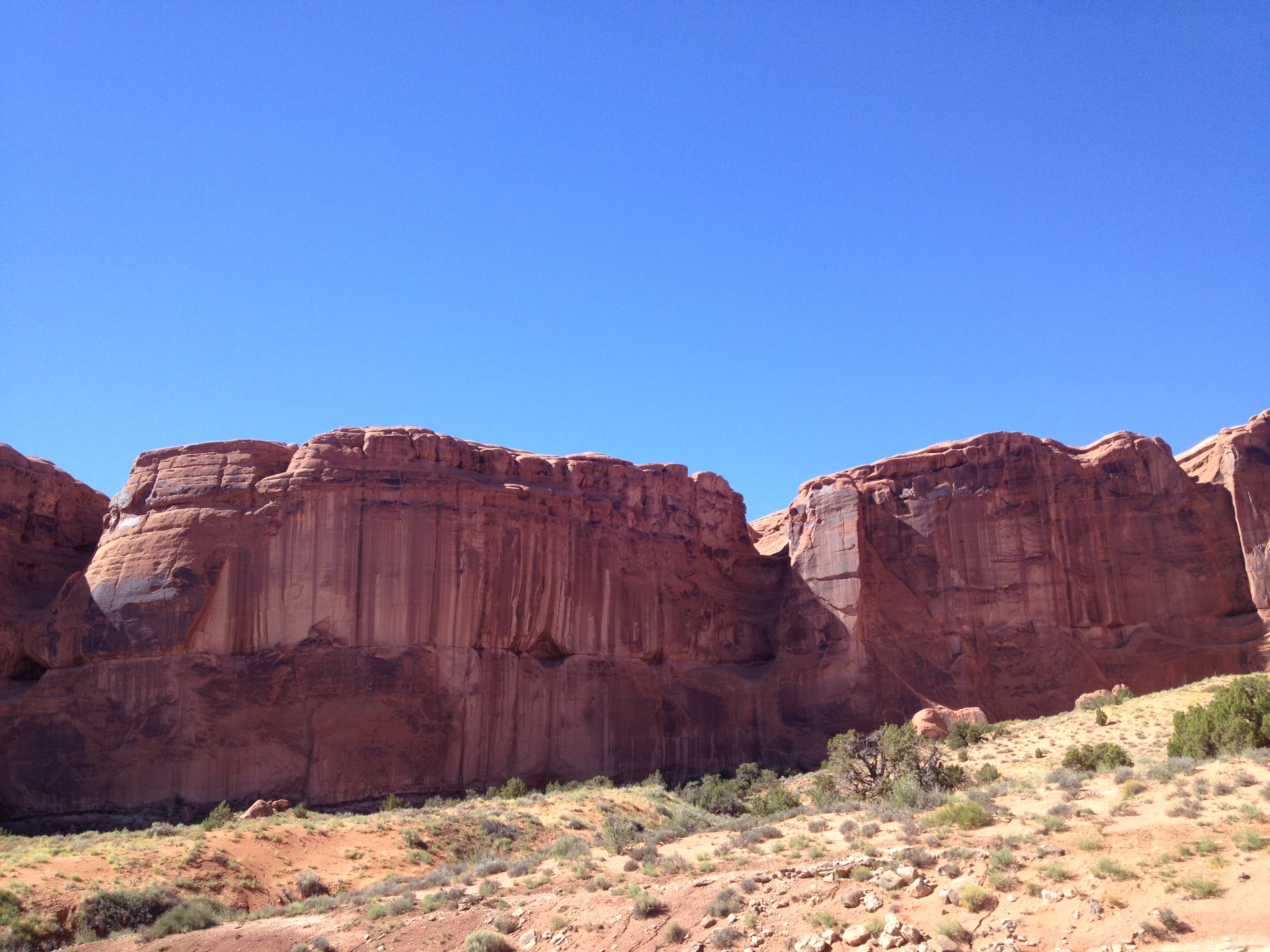
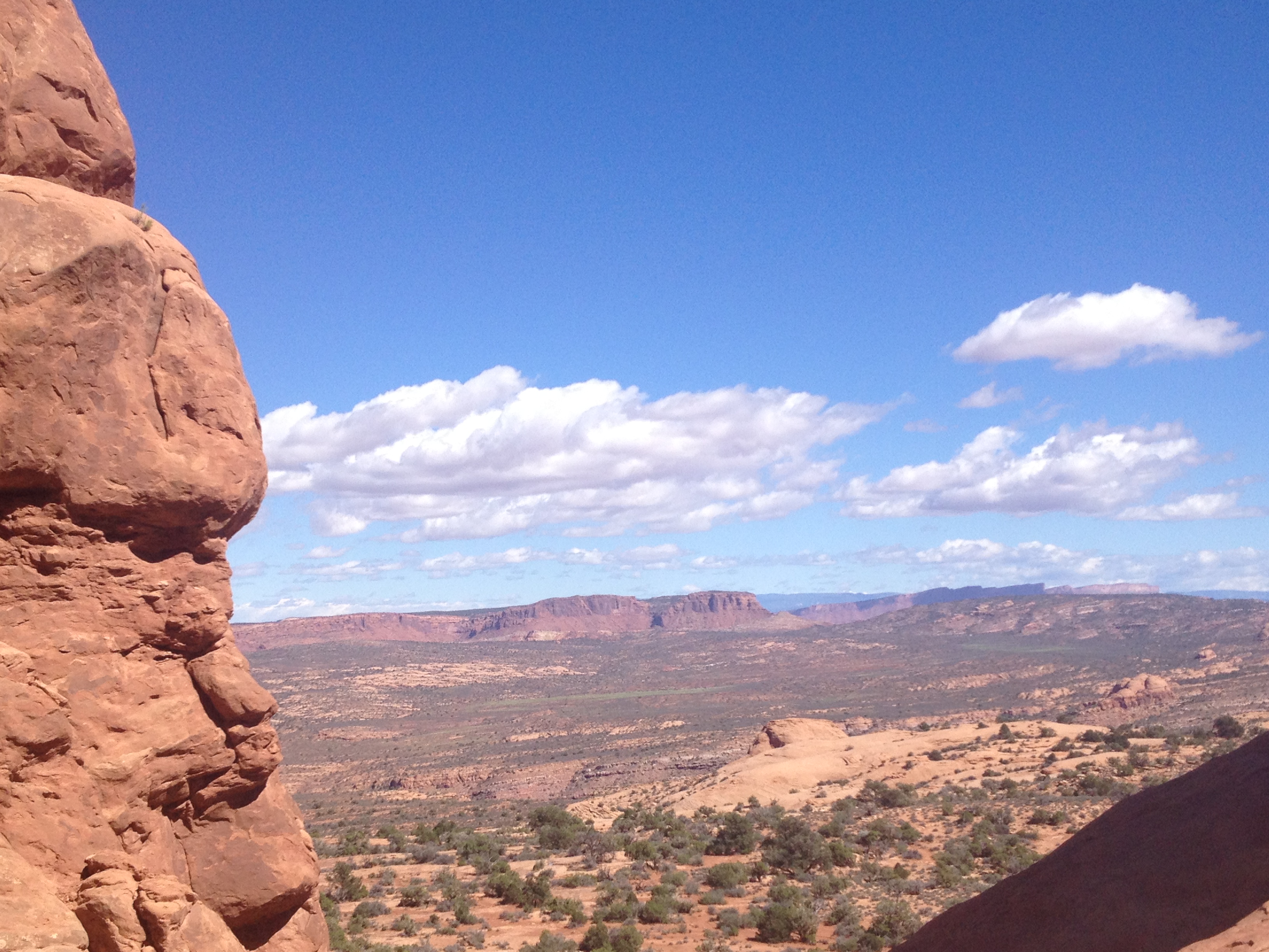
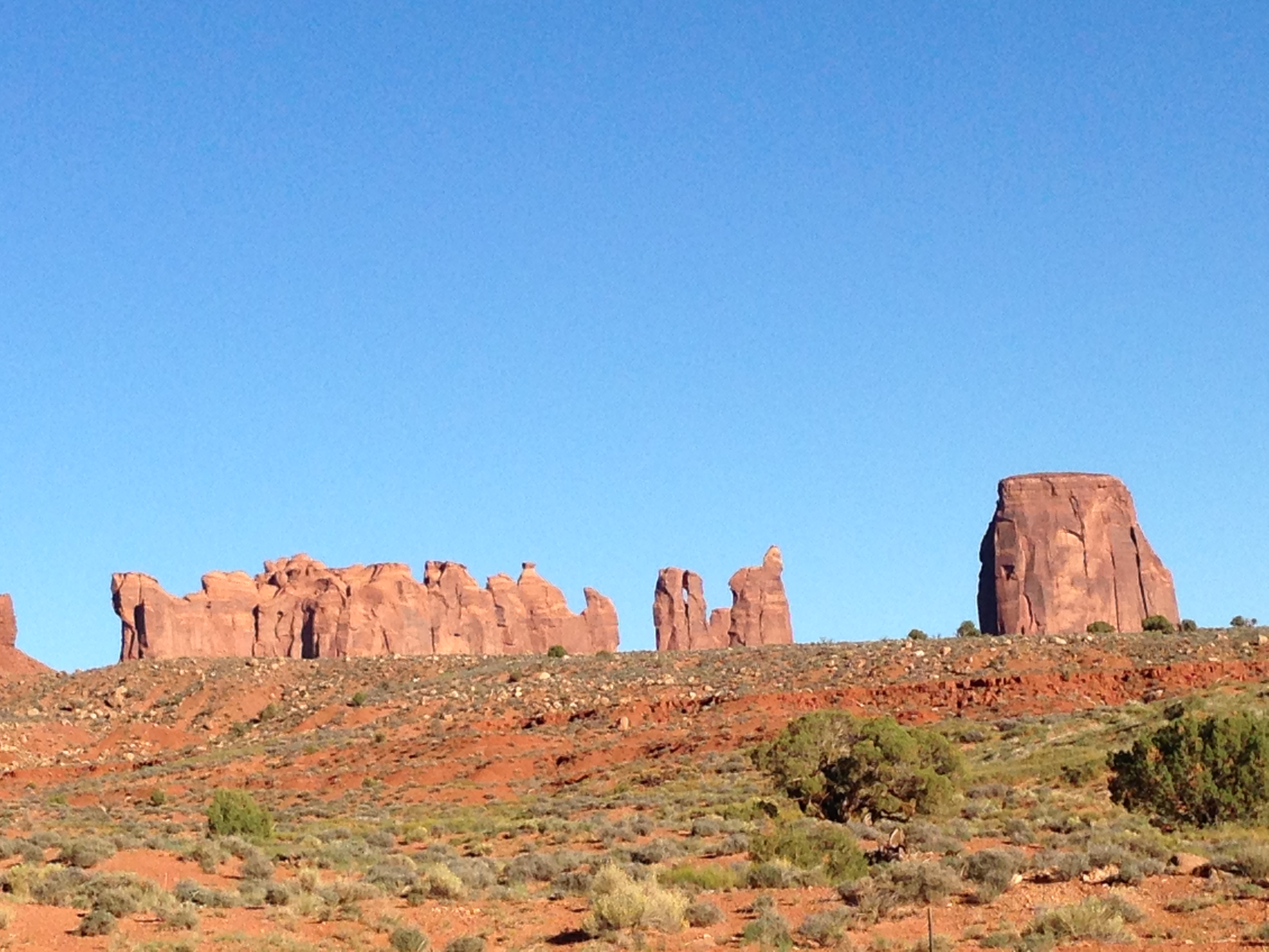
We arrived at Arches National Park in the early afternoon and ended up staying there longer than I planned because it was such an incredible place. The park has over 2,000 arches, plus hundreds of pinnacles and balanced rocks. As the park’s site says, “This red rock wonderland will amaze you with its formations” and it truly and completely does. I can only imagine how stunning a sunrise or sunset must look there.
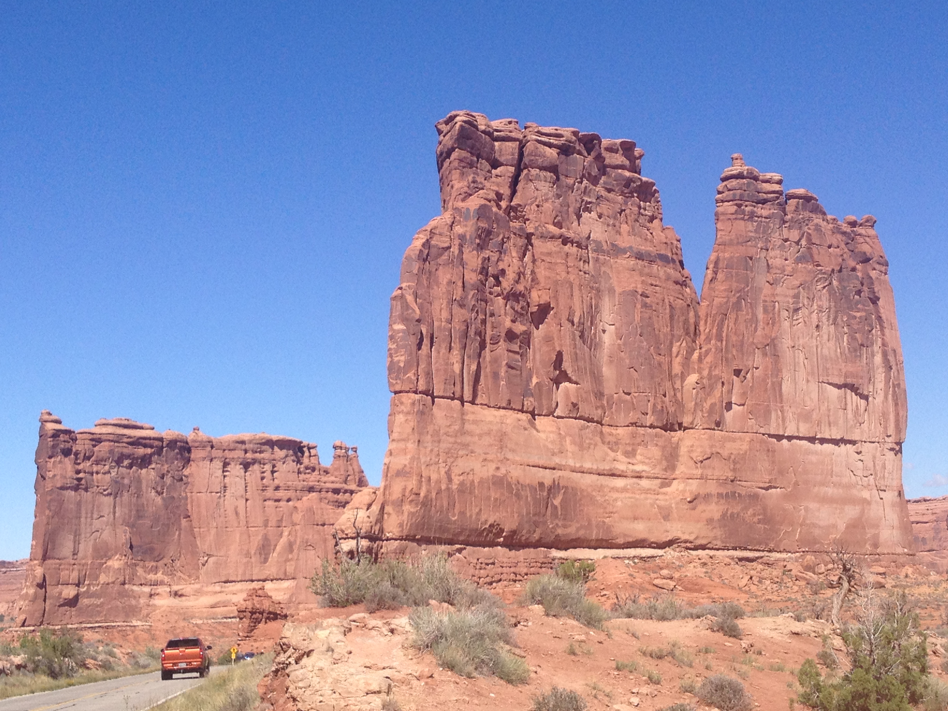
Arches National Park is a very easy park to navigate as there is a main paved road that leads through the park with signs for each viewpoint and trail clearly marked. As we began our scenic drive we could see the La Sal Mountains in the distance, and then pulled over for our first stop at the Courthouse Towers Viewpoint to see The Organ, the Three Gossips, the Sheep Rock and the Tower of Babel. We then drove to the Balanced Rock and hiked its short trail to get a closer look at this incredible precariously-positioned rock.
Our first National Park on this road trip.
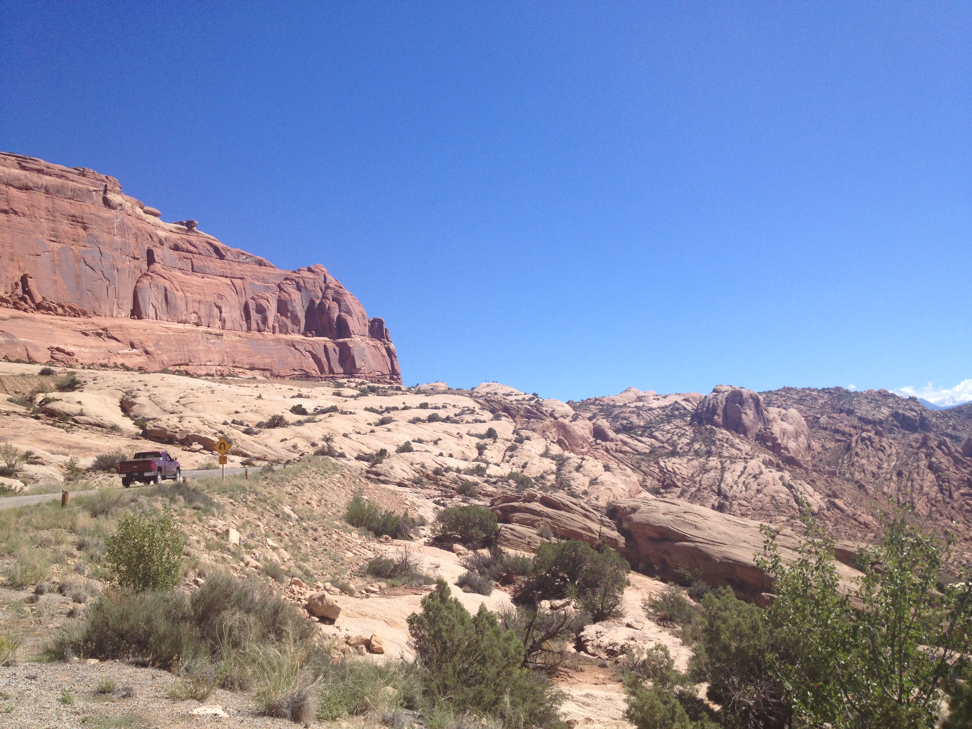
Winding up the main road into the park.
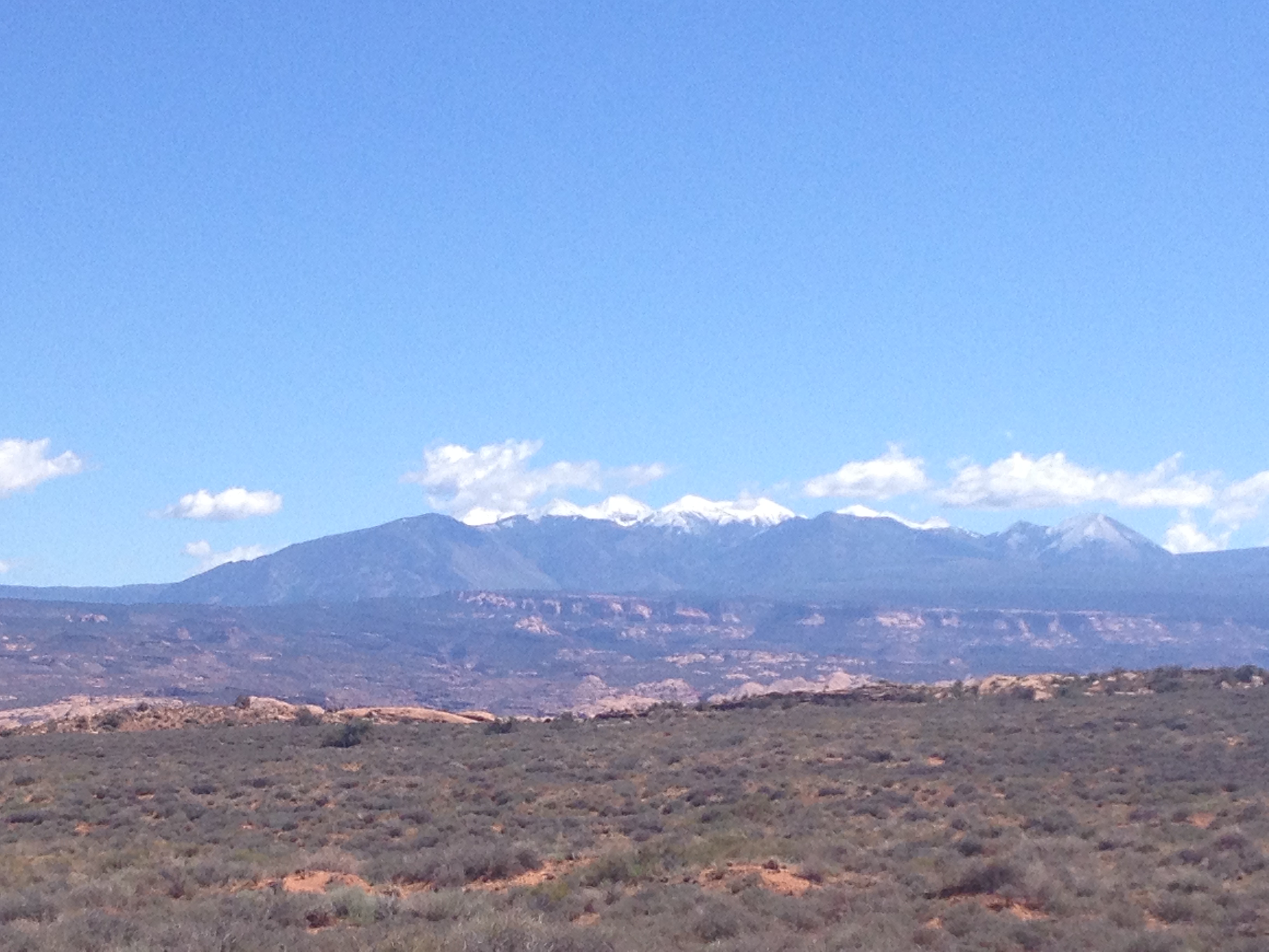
The La Sal Mountains in the distance.

Zooming in on the snow-capped mountains.
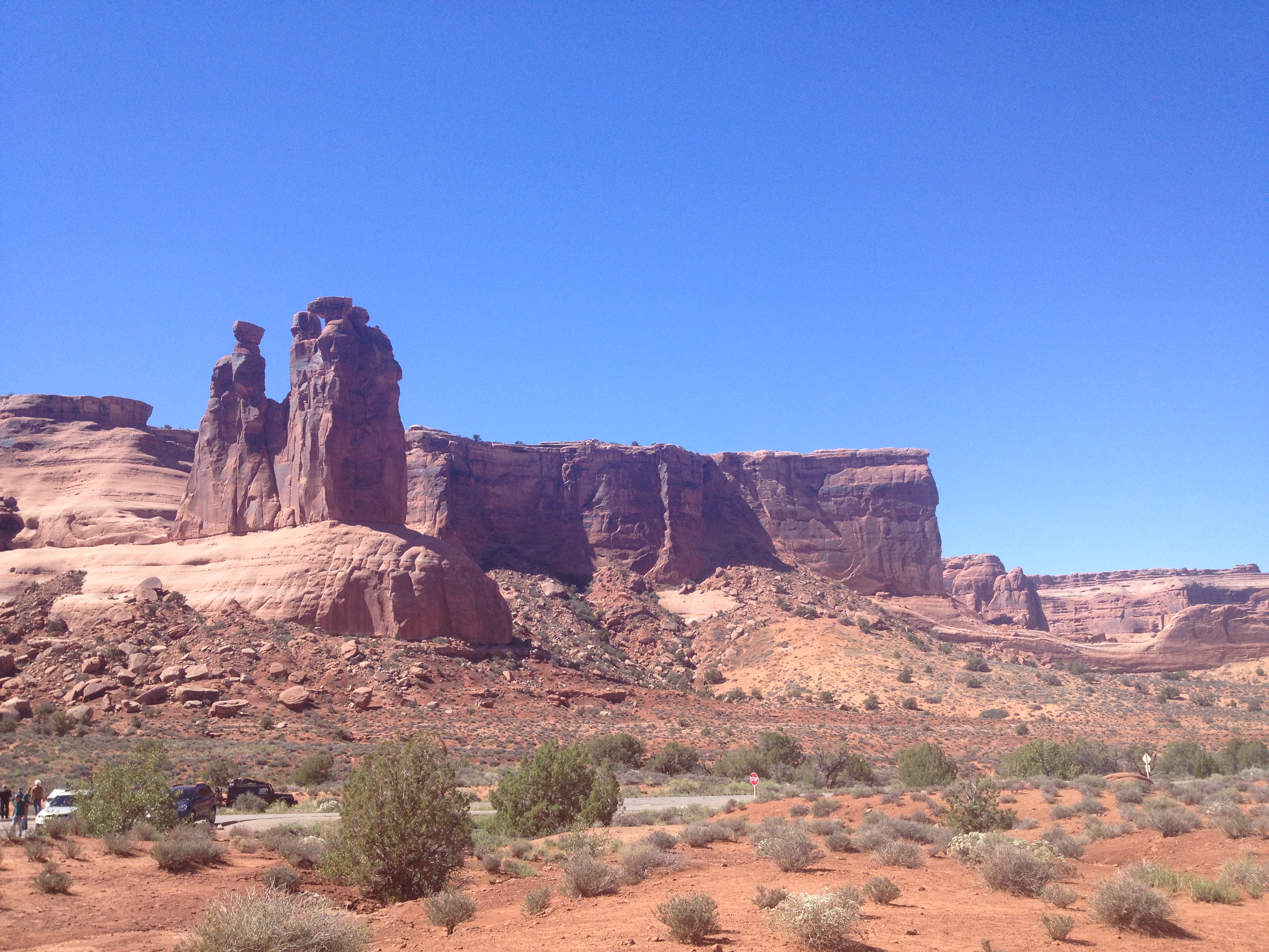
Our first stop in Arches NP at Courthouse Towers

The Organ at Courthouse Towers

Tower of Babel at Courthouse Towers

The Three Gossips
Courthouse Towers Viewpoint
Arches National Park “lies atop an underground evaporite layer or salt bed, which is the main cause of the formation of the arches, spires, balanced rocks, sandstone fins, and eroded monoliths in the area.”

Arches was originally established as a National Monument in 1929 by President Hoover, and did not become a National Park until 1971. http://www.nps.gov/arch/historyculture/founders.htm

I love that we had such a clear day…the color contrast is beautiful!

The formations of these rocks are just incredible and some seem unfathomable to me.

“Arches is located in a ‘high desert’, with elevations ranging from 4,085 to 5,653 feet above sea level.” http://www.nps.gov/arch/naturescience/index.htm

The Balanced Rock used to have a companion, which was a similar but much smaller balanced rock named “Chip Off The Old Block”. Sadly it fell during the winter of 1975/1976.

The top of the Balanced Rock is the size of three school buses.
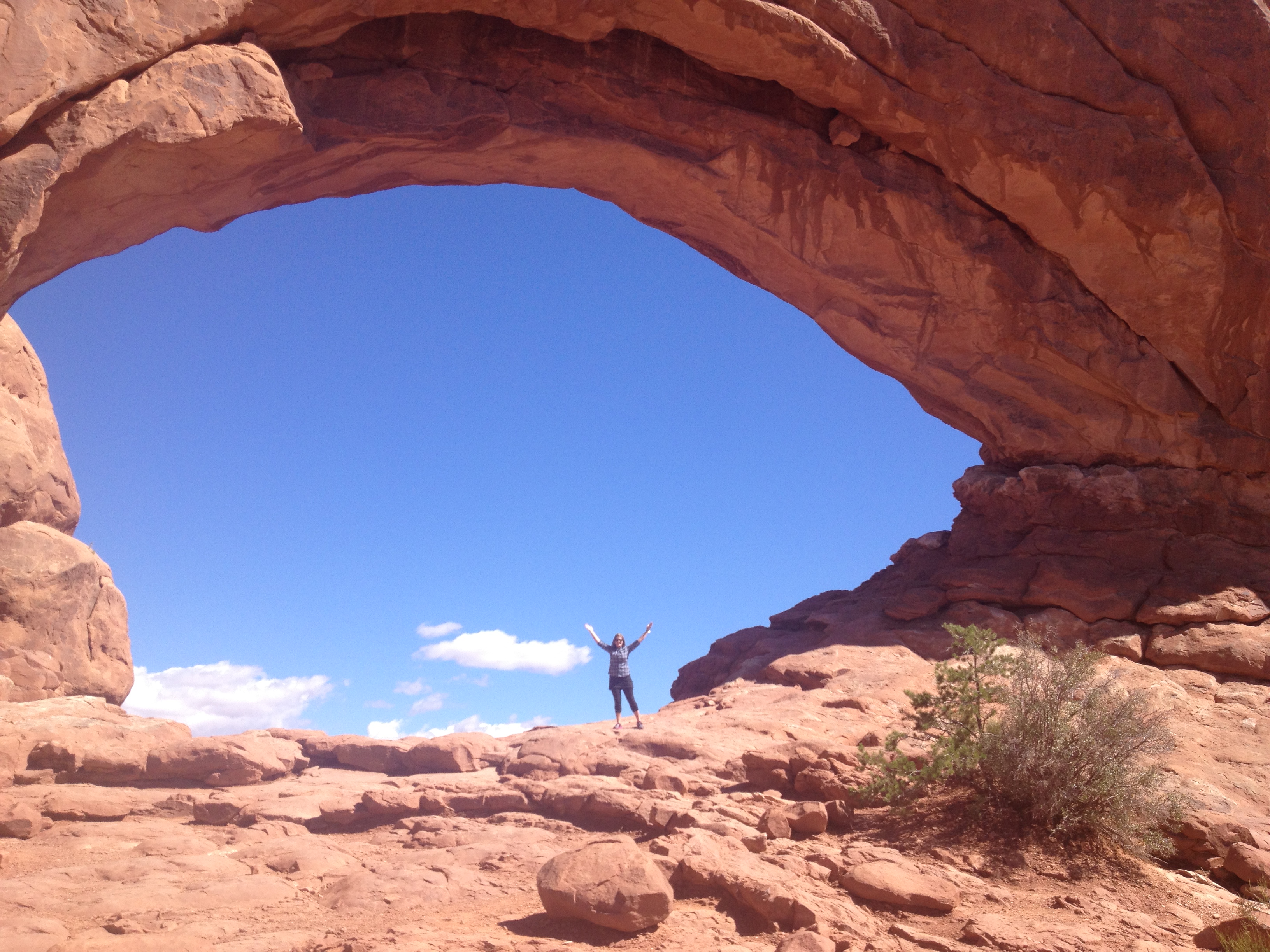
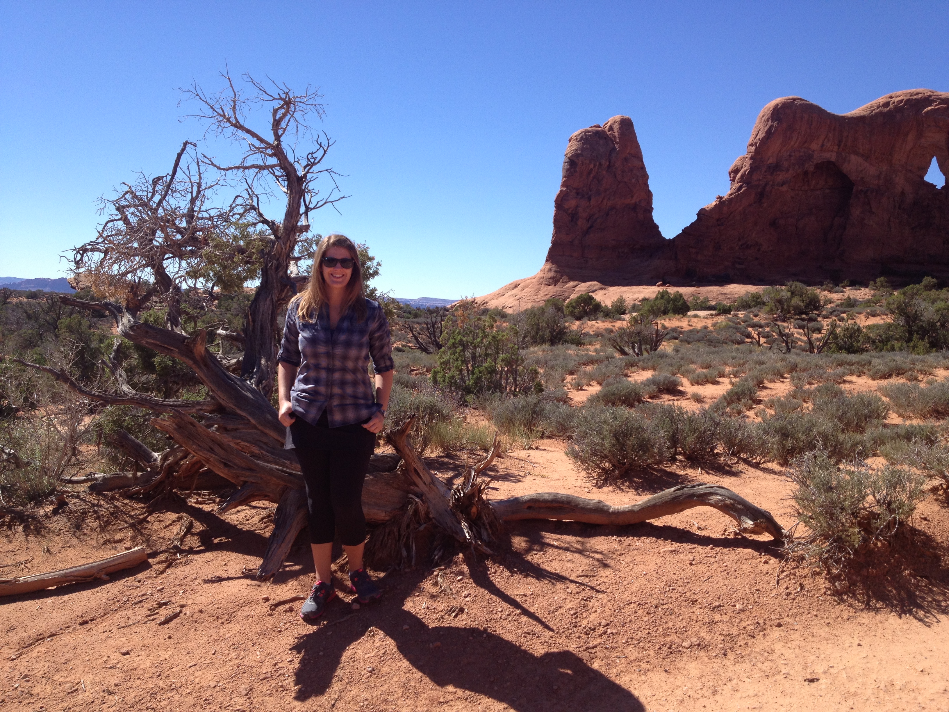
Next, we ventured to the Windows loop trail to view the North Window up close. We also saw the South Window and Turret Arch from there, but since we were on a bit of a time constraint we did not hike up close to those.
I’m having fun visiting America’s National Parks!
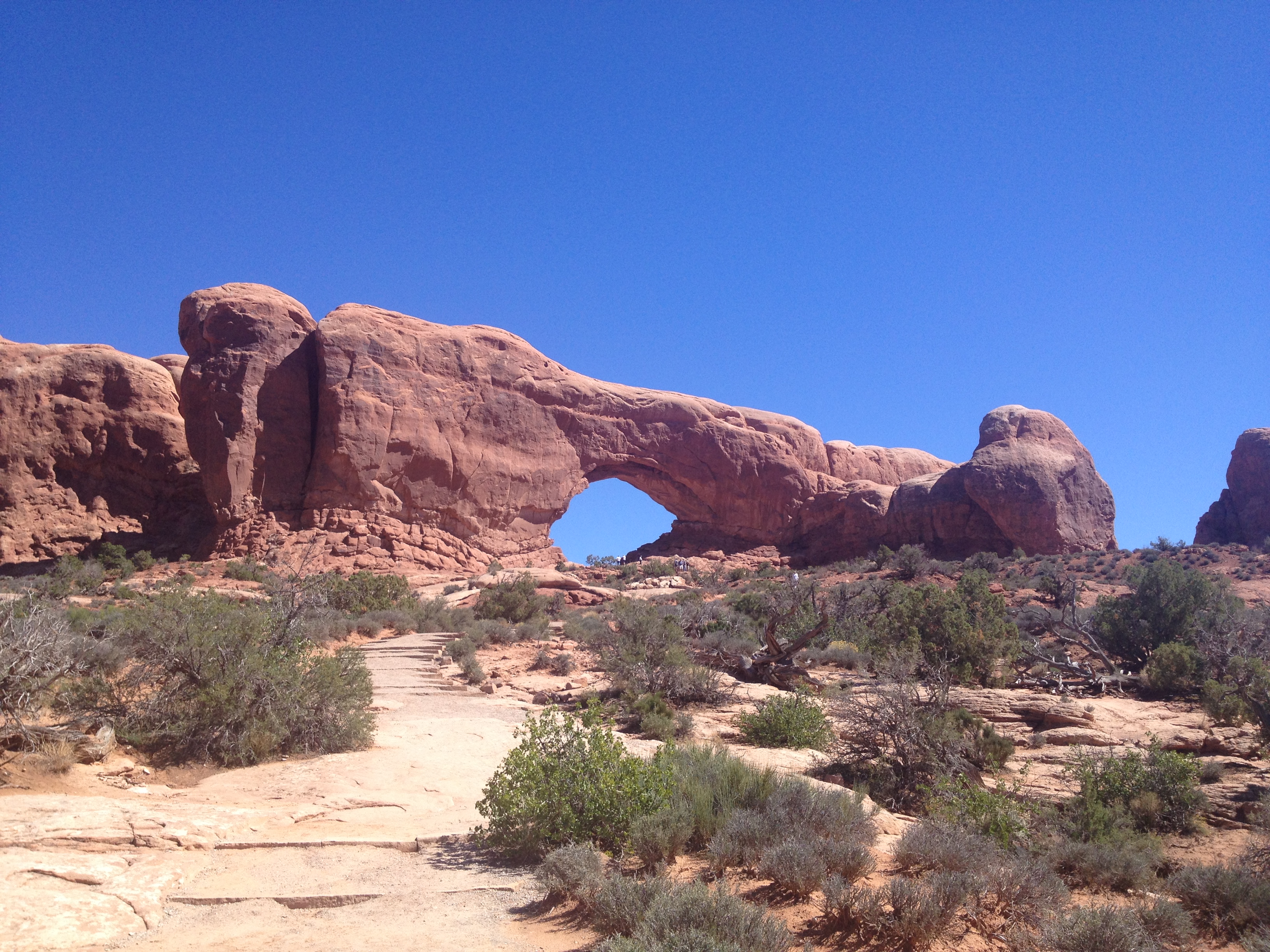
The trail to the North Window

North Window
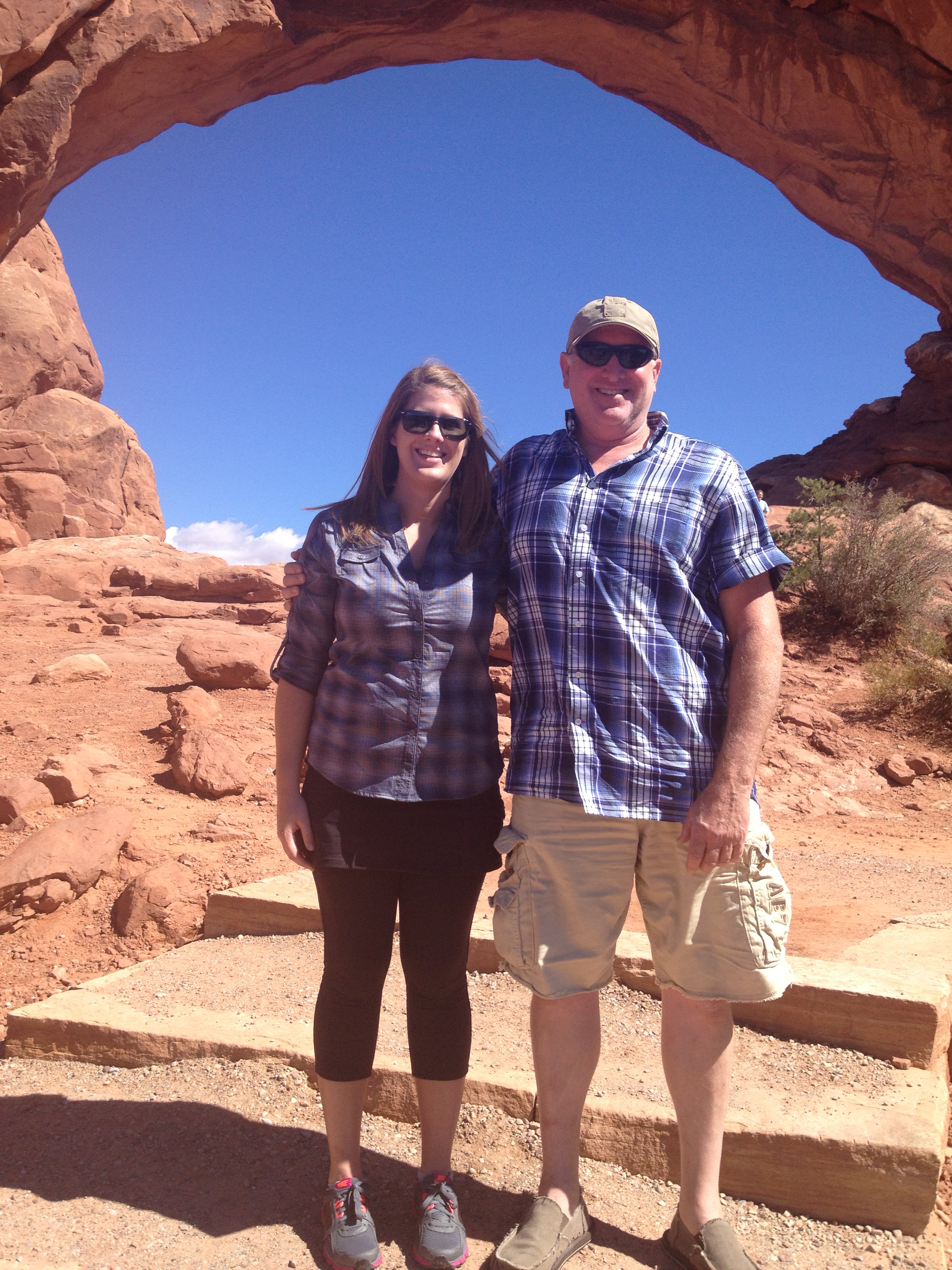
Me and Papa Kyle
Walking in a red rock wonderland!

Yippee!
Looking out at the plateau from the North Window

There is a huge drop-off behind me!

The view of the Turret Arch from the North Window.
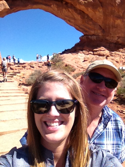
Selfie time at the North Window.
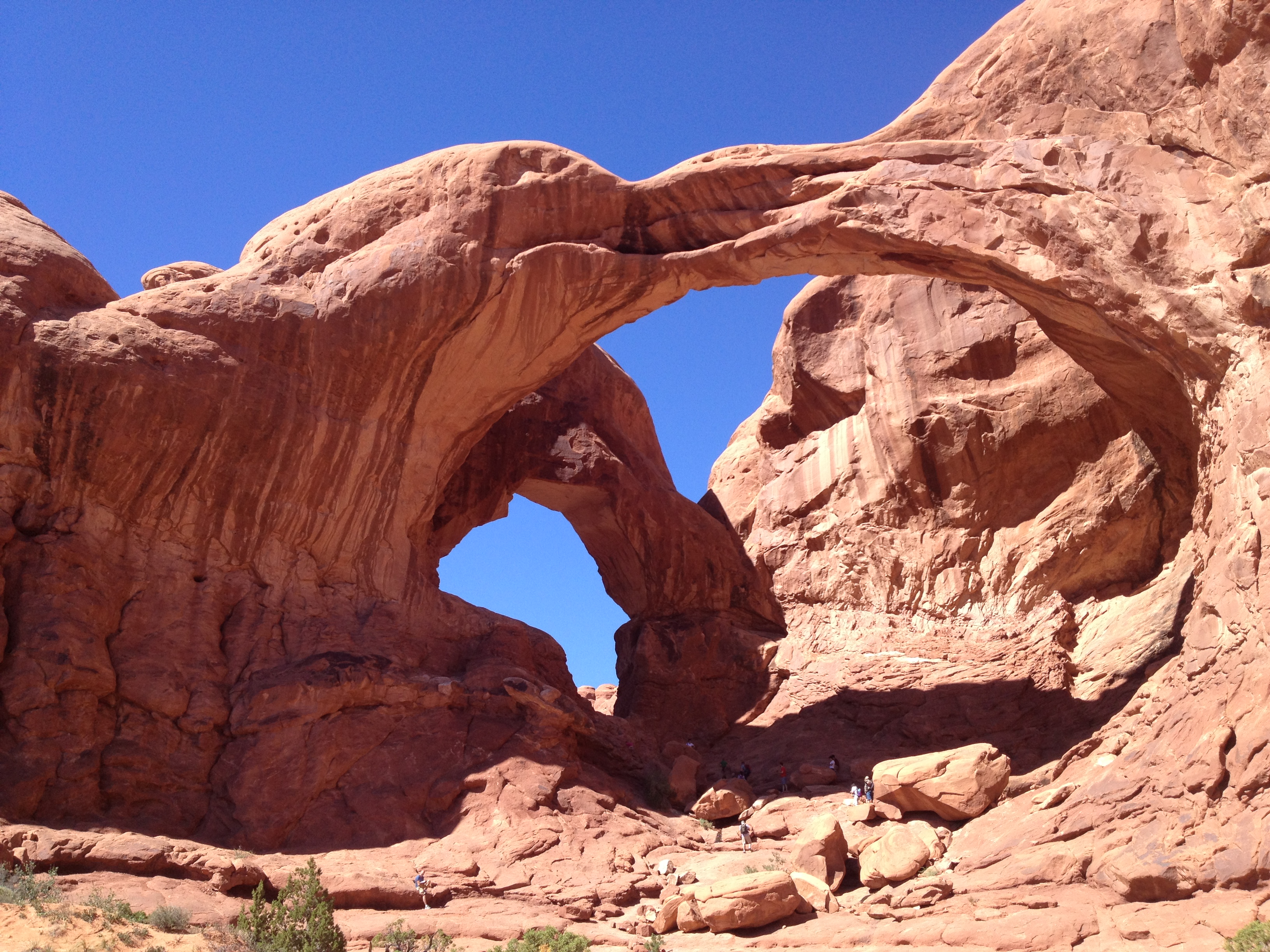
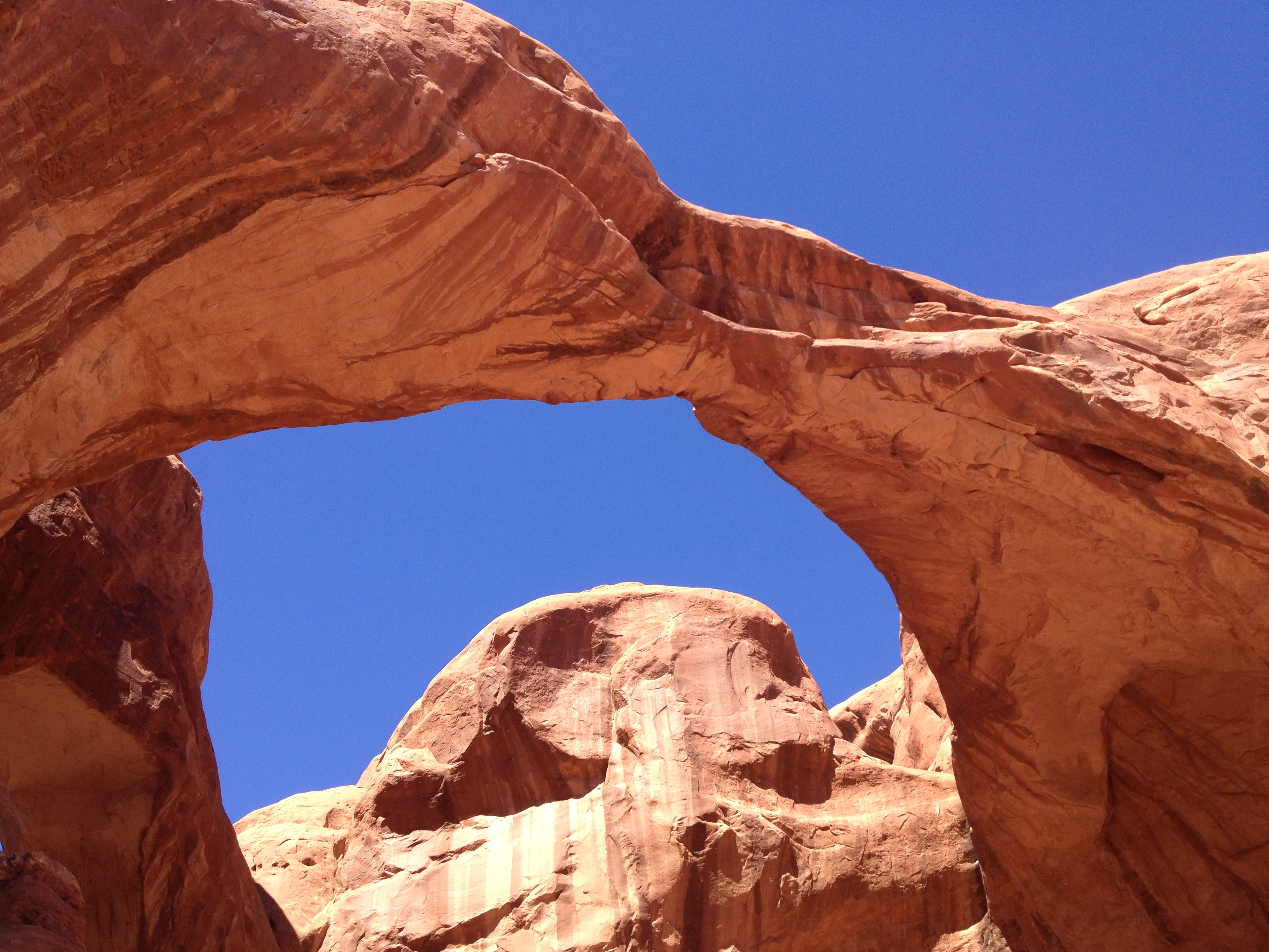
Our last stop in Arches National Park was to hike to the Double Arch, and this was definitely my favorite of the sites. I think it’s impossible to take a bad picture of this formation. You can hike/rock climb pretty far up to the arch and behind it, but without proper hiking shoes I did not feel comfortable doing that. But I did climb a bit of the way.

The Double Arch is such an impressive formation!

I love how blue and clear the sky was that day.
To qualify as an official stone “arch,” a hole
must have an opening at least three feet long in any one direction. But there is no
requirement for width.

The Double Arch was formed differently than most of the arches in the park. It was formed by water erosion from above rather than more typical erosion from the side.

It’s awesome how visitors are free to walk right under the arches.
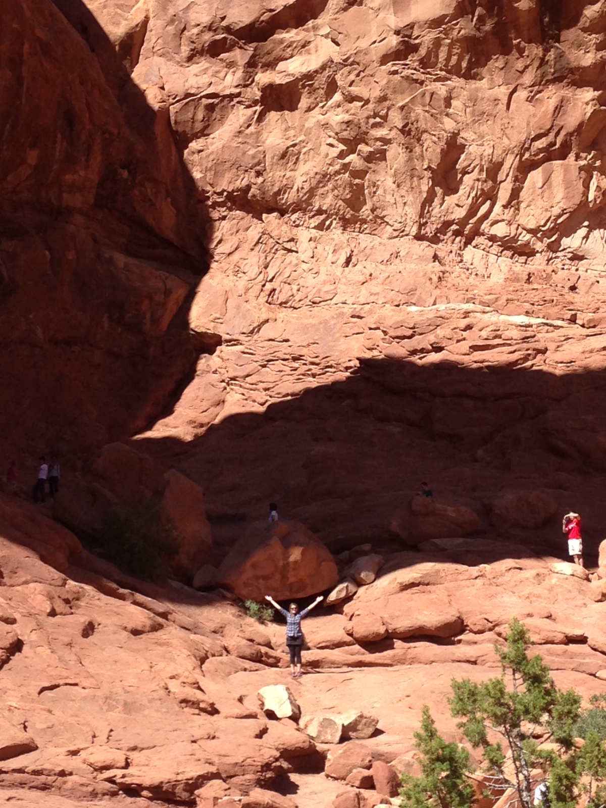
I feel so small.
The blue is so vibrant against the red rock. Love it!

The rock climbing is much steeper than this picture looks.

View of the Window and Turret Arches (in the far distance) from the Double Arch.

Photobombed!

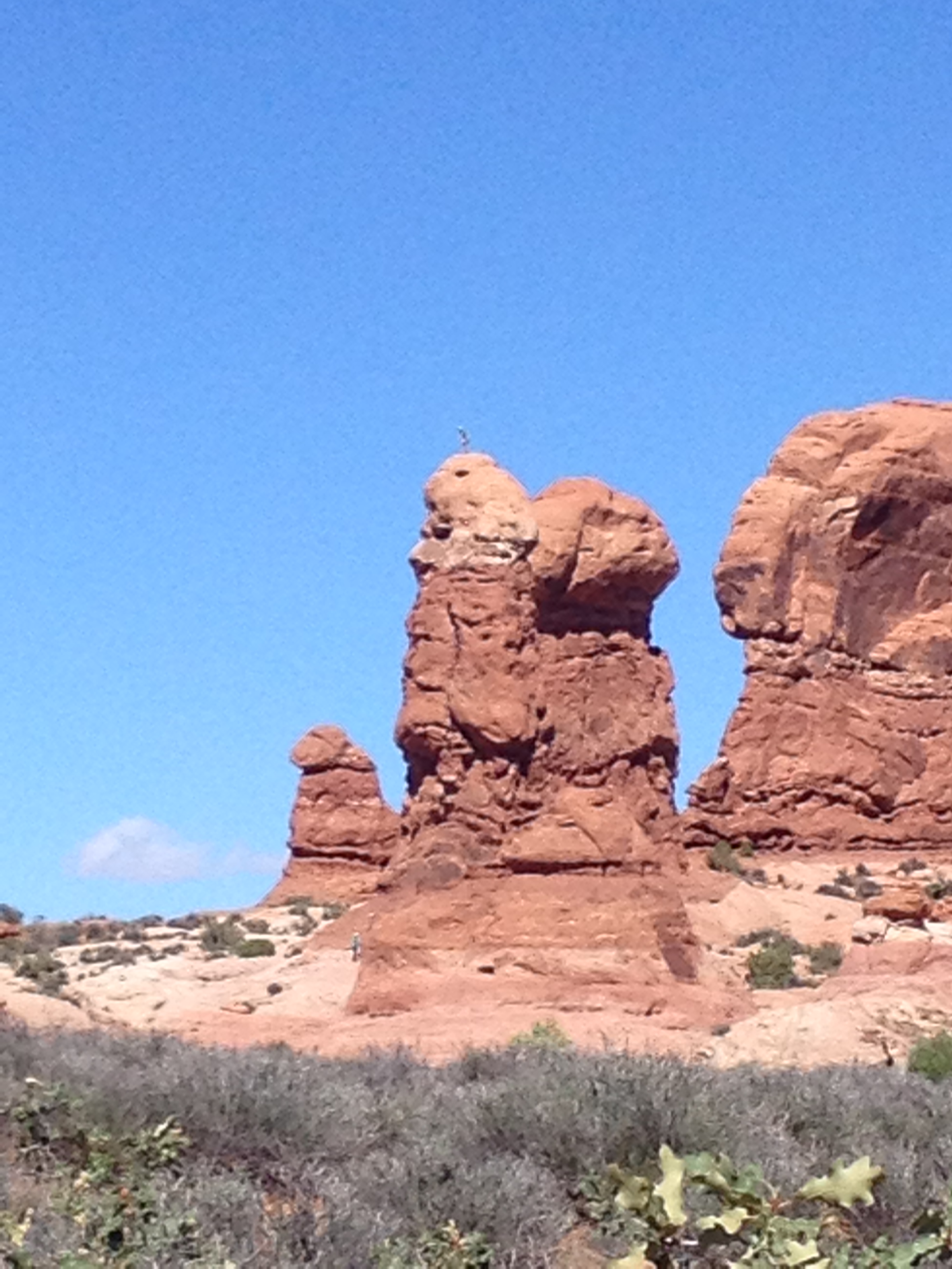
Dad and I named this the Lion Rock…though, that is probably it’s name already lol.
I’m looking forward to revisiting this park! I bet camping here overnight would be fantastic for stargazing!
On our drive out, we saw a guy on top of this rock!! I did not know you could rock climb up it (still not sure if that was legal) but the rock climber seemed confident up there. I don’t have a fear of heights per se, but I have a fear of falling. (Maybe that does mean I have a fear of heights…but regardless, it looked damn scary for that rock climber!)

Glenwood Springs to Arches National Park to Monument Valley
After making sandwiches for lunch at the park, we reluctantly got back in the car to continue our long drive. Our next destination was to drive through Monument Valley, which is a region of the Colorado Platueau within the Navajo Indian Reservation that borders Utah and Arizona. Monument Valley served as the backdrop to many of director John Ford’s Western films, and thus he made Monument Valley famous to moviegoers as the landscape of the American West. http://navajonationparks.org/index.htm

Driving into Monument Valley on Highway U.S. 163.
As we drove through Monument Valley you can’t help but feel transported back to the Wild West and a time of cowboys and outlaws (we can mostly thank John Ford for this association). I can easily see why this was John Ford’s favorite place to film; its unchanged natural scenery is a reminder of a lawless frontier during America’s quest to expand westward. The Wild West is a tale of America’s frontier history, which is one of conquest, survival and the convergence of cultures; and you can feel transported to the Wild West in Monument Valley. The American West has become such a defining symbol for American history that there is a whole genre of fiction and film dedicated to retelling tales of the West; and with Monument Valley’s towering mesas and sandstone buttes rising amid wide open desert spaces, it’s no wonder this region has been chosen to represent the unruly and uncharted territories of the American West in so many Western films.
[Here is a list of the movies filmed in Monument Valley. http://www.imdb.com/search/title?locations=Monument%2520Valley&&exact=off ]

The elevation of the valley floor ranges from 5,000 to 6,000 feet.
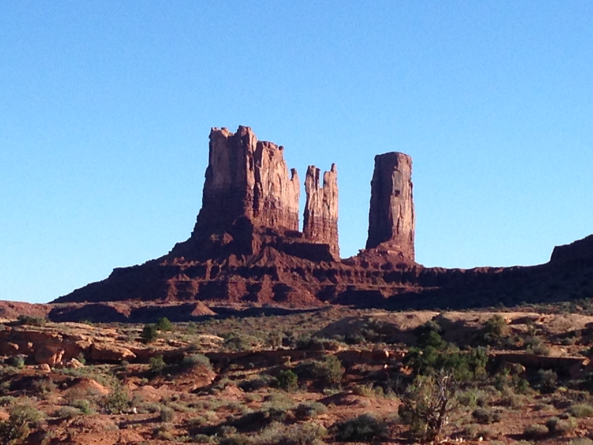
The isolated red buttes and mesas provide some of the most enduring and expressive imagery of the American West.
“Monument Valley is officially a large area that includes much of the area surrounding Monument Valley Navajo Tribal Park, a Navajo Nation equivalent to a national park.”

The largest sandstone butte in Monument valley reaches 1,000 feet.
The sun started to set as we left Monument Valley and we still had a four hour drive until we reached our hotel in the Grand Canyon. And let me tell you, it is like for real pitch black when the sun goes down in the desert. But we did make it safely to our hotel by about 9pm and enjoyed the incredible views of a star-filled sky. We stayed at Yavapai Lodge inside Grand Canyon National Park (there are several hotels and lodges to choose from) and I highly recommend staying at the Grand Canyon Village. The rooms are very nice and decent priced (at least for the off-season they are) and it’s obviously extremely convenient to stay inside the park, especially when the nearest big city is Flagstaff, eighty miles away.

Monument Valley to Grand Canyon
The next morning, after we ate breakfast at the cafeteria in the Market Plaza (which is within the Grand Canyon Village and has a general store and deli, a bank, post office, and the cafeteria), we headed to the visitor center so I could get my passport stamp. Right now, I’m sure you all are very curious as to what this passport stamp is. Am I stamping my real passport? Is the the Grand Canyon it’s own country? No and No. Earlier this the year, my brother bought me a “passport” to the national parks as a birthday present while we were at Cape Hatteras National Seashore in North Carolina. So on this road trip I collected a stamp at each National Park we visited. It was pretty cool to get a stamp at each park and it was a also a very handy guide to see what other parks were in our area. http://passport.eparks.com/store/product/22515/%2APassport%C2%AE-To-Your-National-Parks%2A/

A few of my stamps from the Western Region of National Parks.
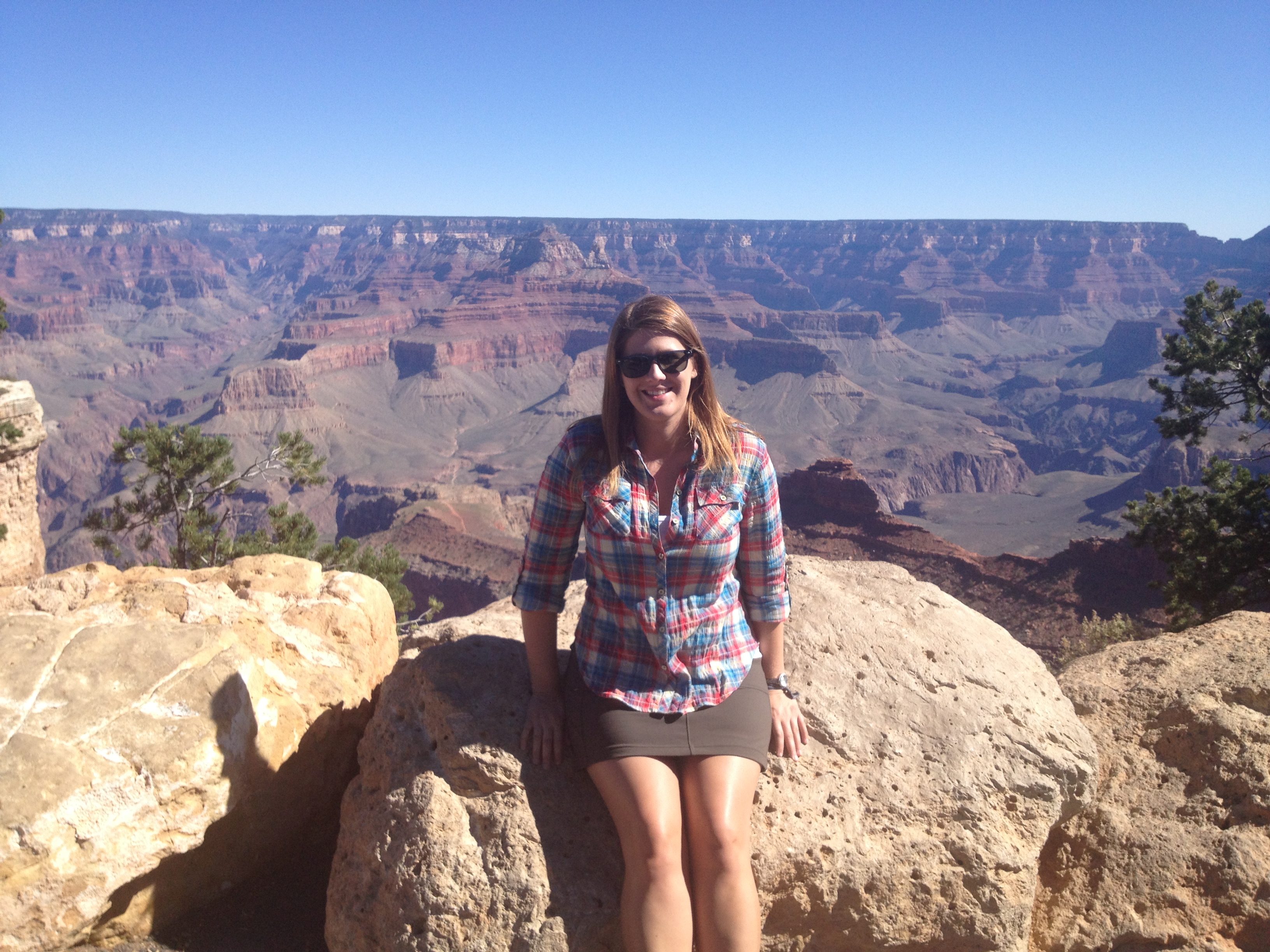
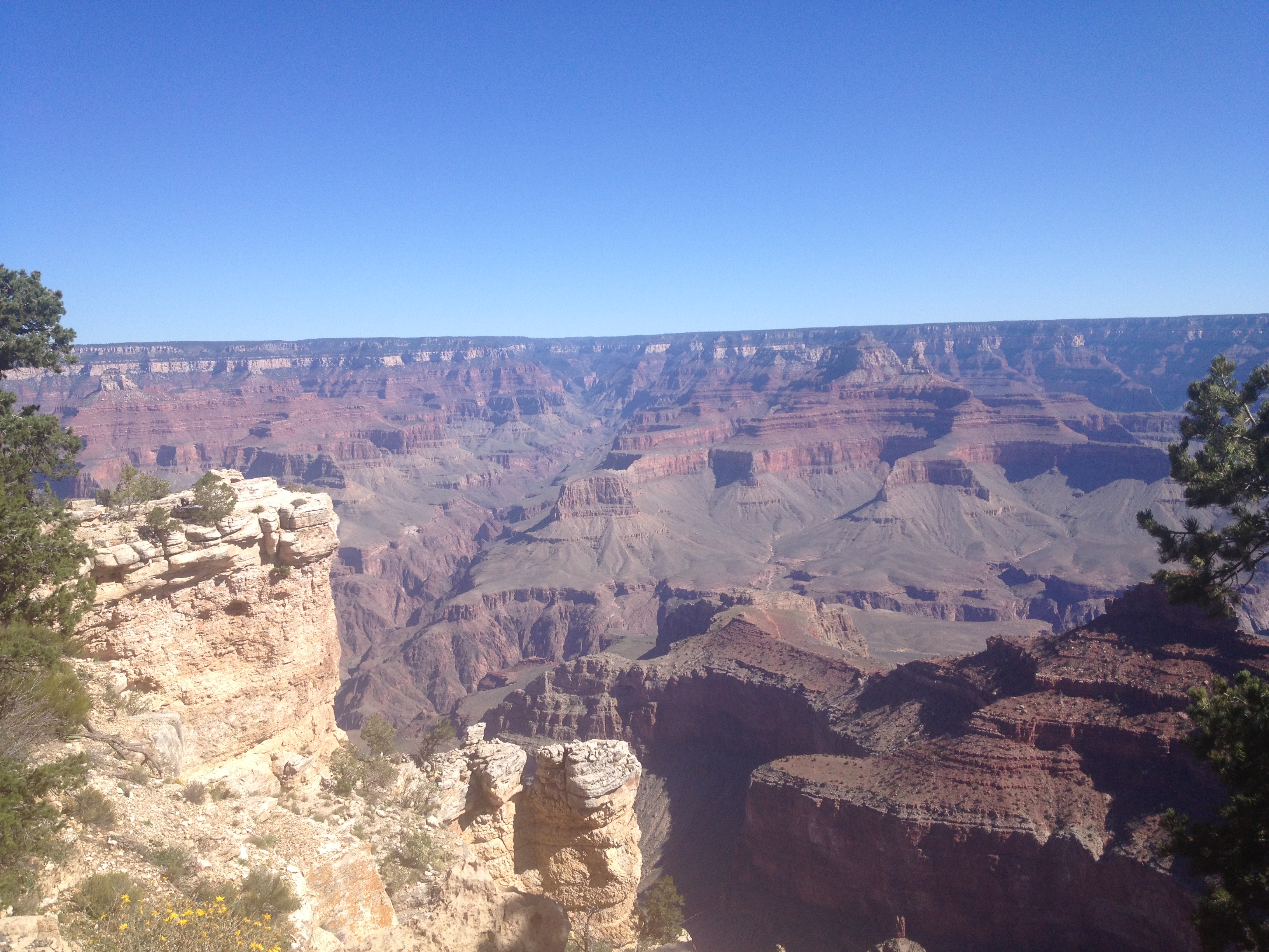
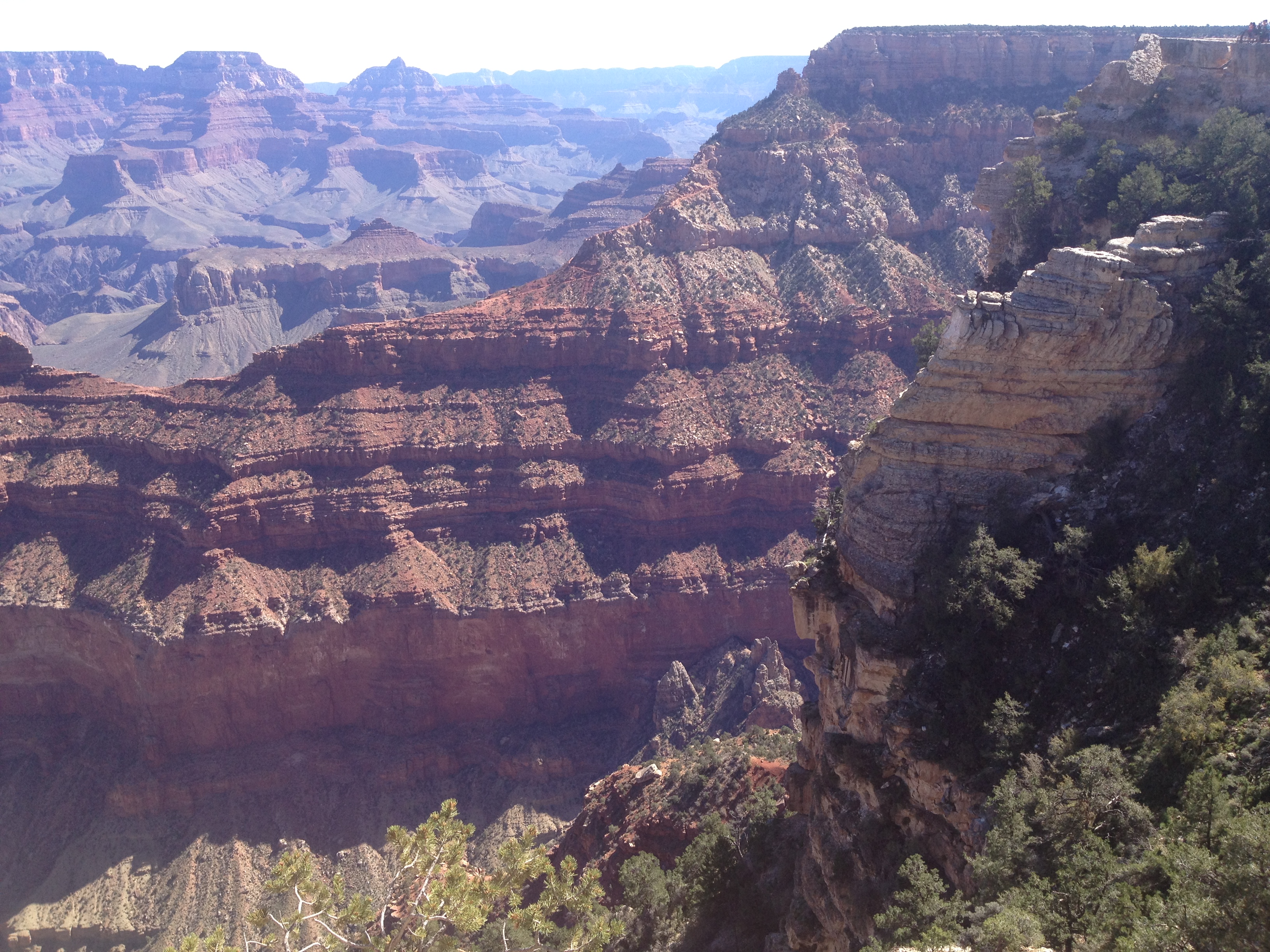
After stamping my “passport”, my dad and I took a little walk to the South Rim to see the Grand Canyon for the first time since our arrival over 12 hours before haha. The sheer size of the Grand Canyon is indescribable. It’s just massive, and such an incredible site. An amazing natural wonder and national treasure. Take that, Europe, with your awesome castles and Gothic cathedrals! We have really big gorges made by water millions of years ago! http://www.nps.gov/grca/index.htm

We made it!

Hanging out with Smokey the Bear!

Smokey has crazy eyes!
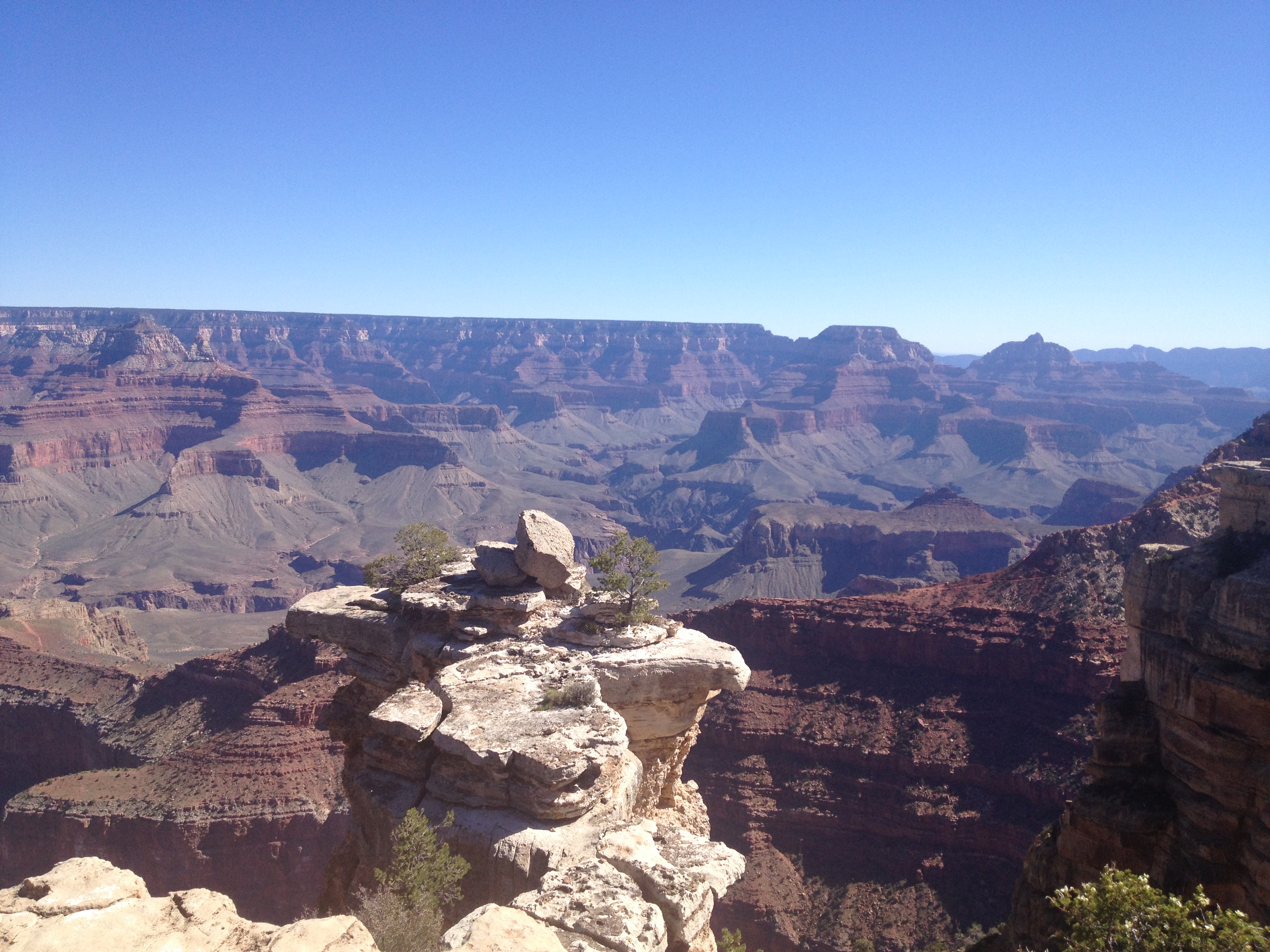
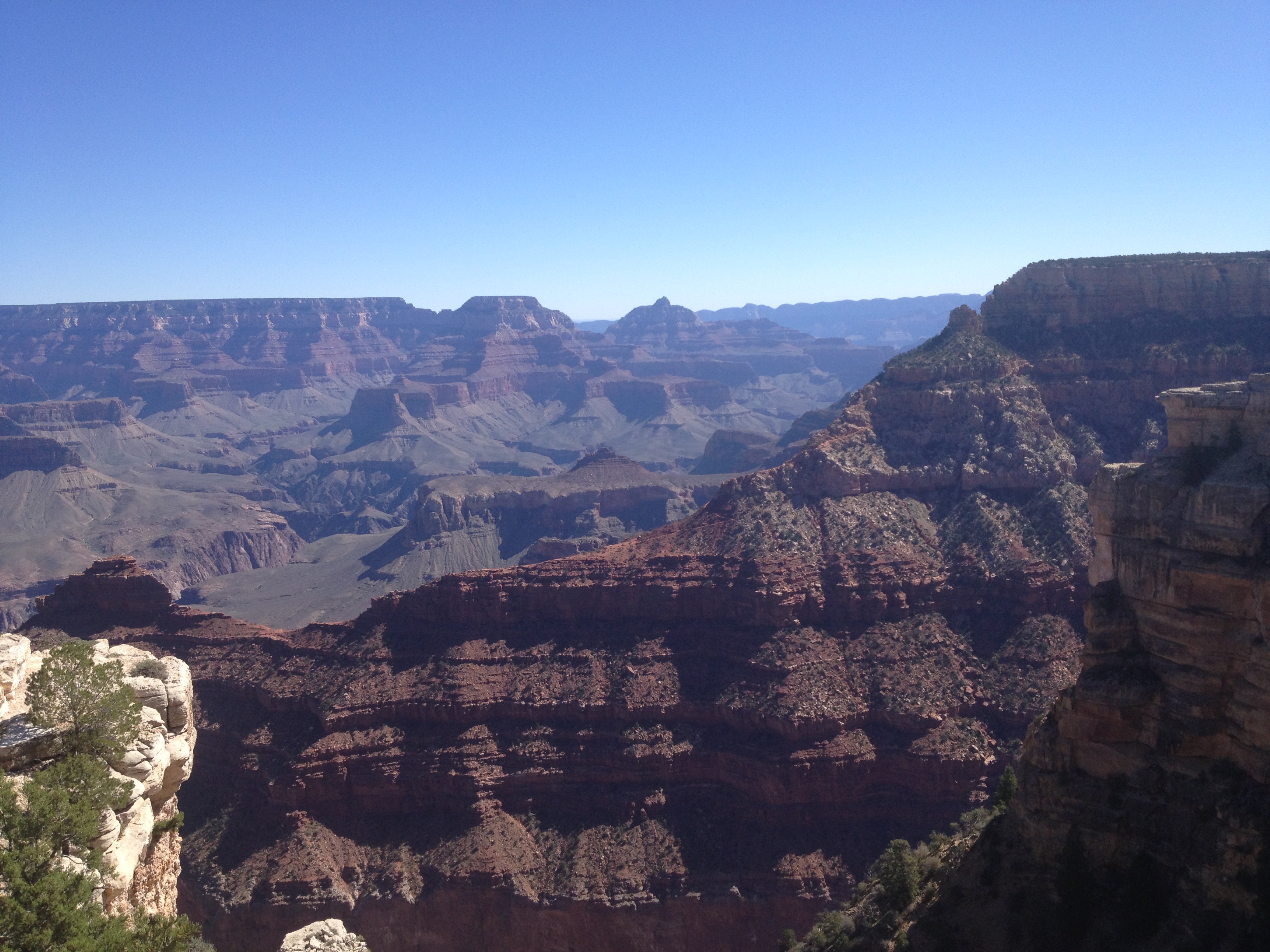
The Grand Canyon!
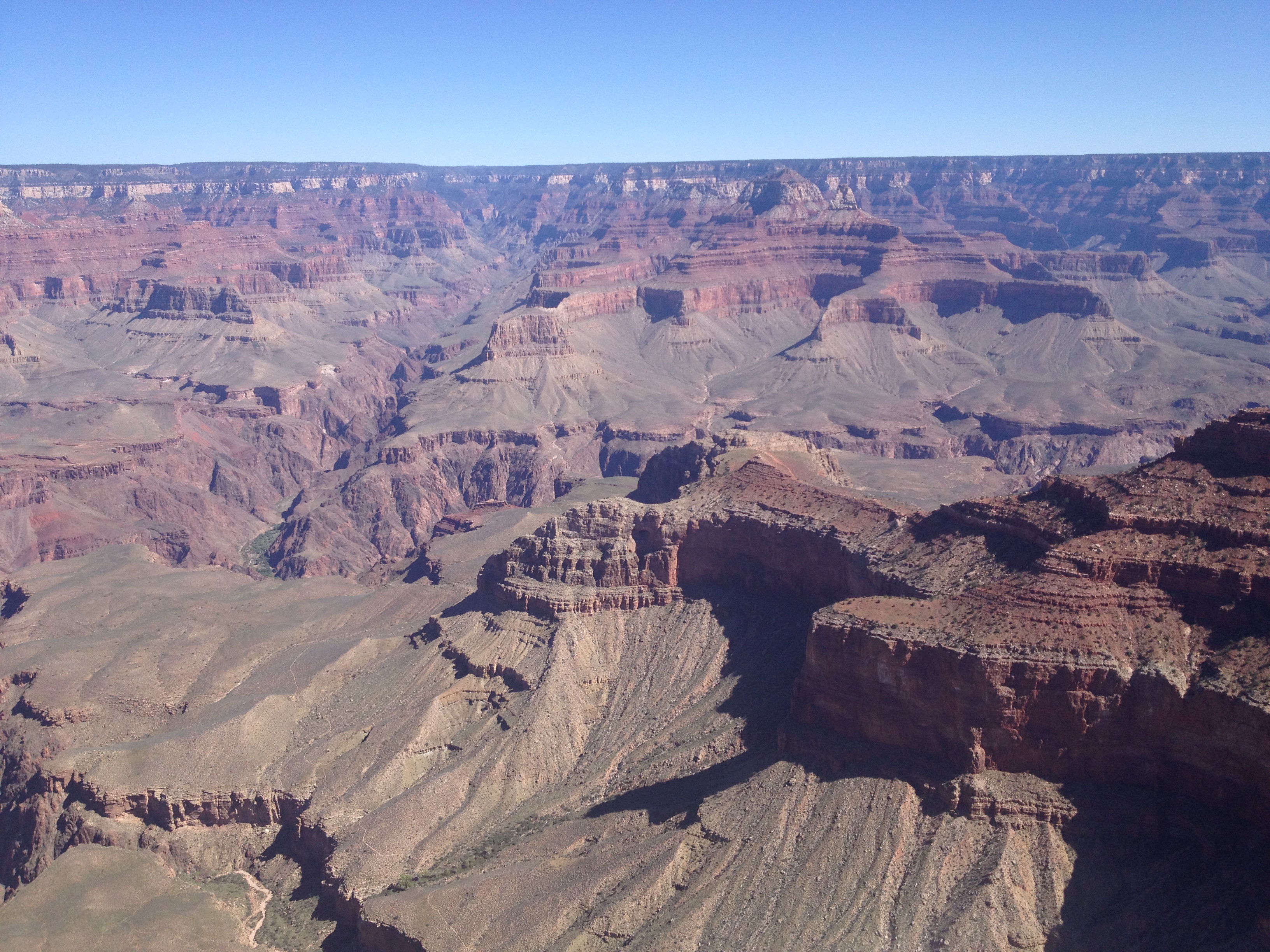
My camera does not do the Grand Canyon justice. It fails to capture the immenseness and depth.
America’s biggest ditch as my dad so eloquently put. 😉
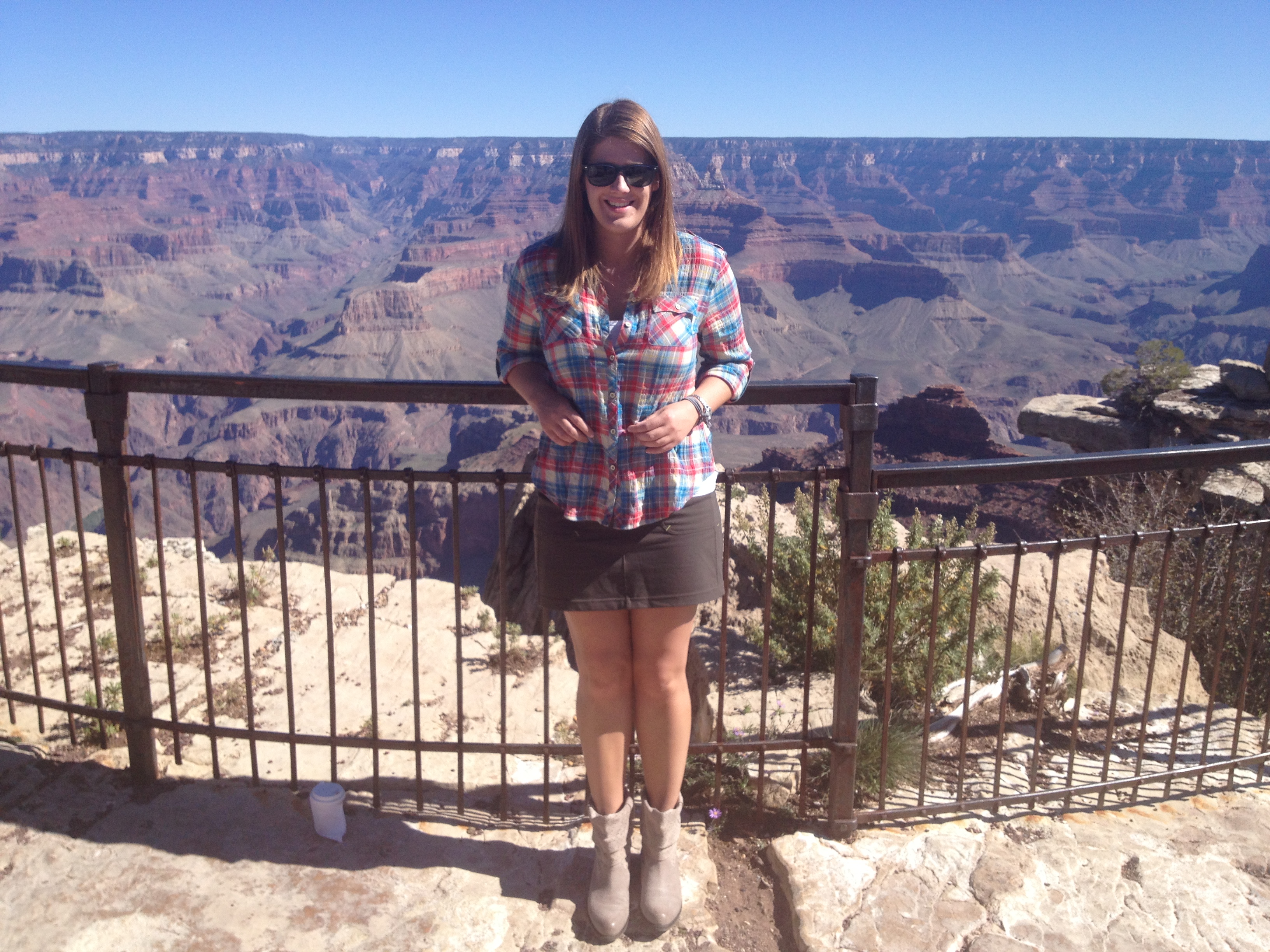
Posing at the South Rim of Grand Canyon, which averages 7,000 feet above sea level.
Grand Canyon was first established as a Forest Reserve in 1893 and then as a National Monument. It became a National Park in 1919, which was three years after the creation of the National Park Service.

This is my second time visiting the Grand Canyon and it still amazes me!
“The more recent Kaibab limestone caprock, on the rims of the Grand Canyon, formed 270 million years ago. In contrast, the oldest rocks within the Inner Gorge at the bottom of Grand Canyon date to 1.84 billion years ago. Geologists currently set the age of Earth at 4.5 billion years.” Mind blowing! http://www.nps.gov/grca/historyculture/index.htm
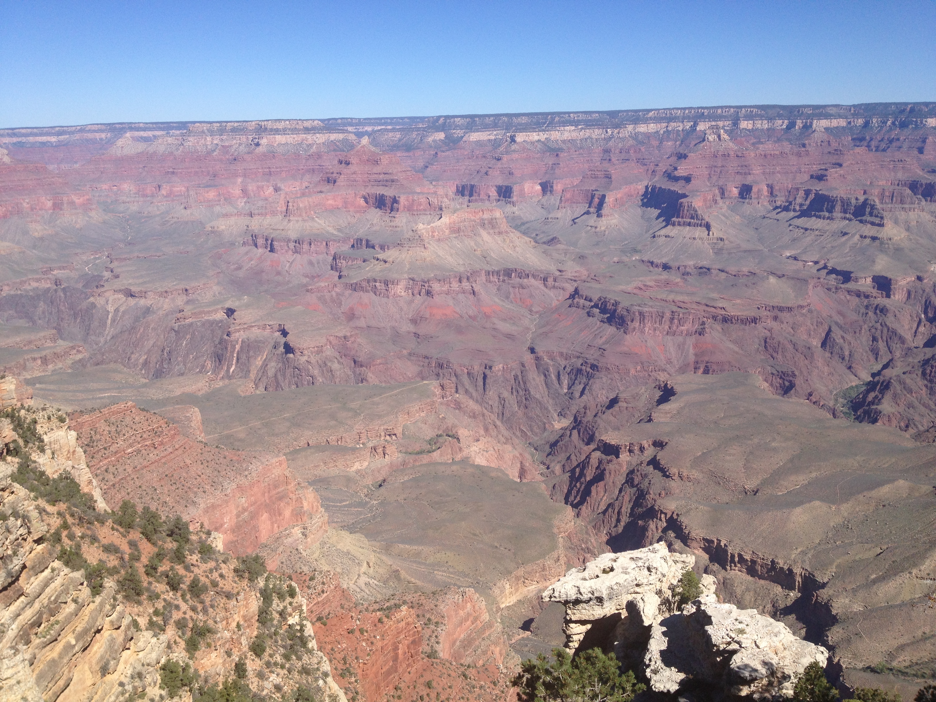
The Grand Canyon is 277 river miles long, up to 18 miles wide, and a mile deep.
I love the colors here!
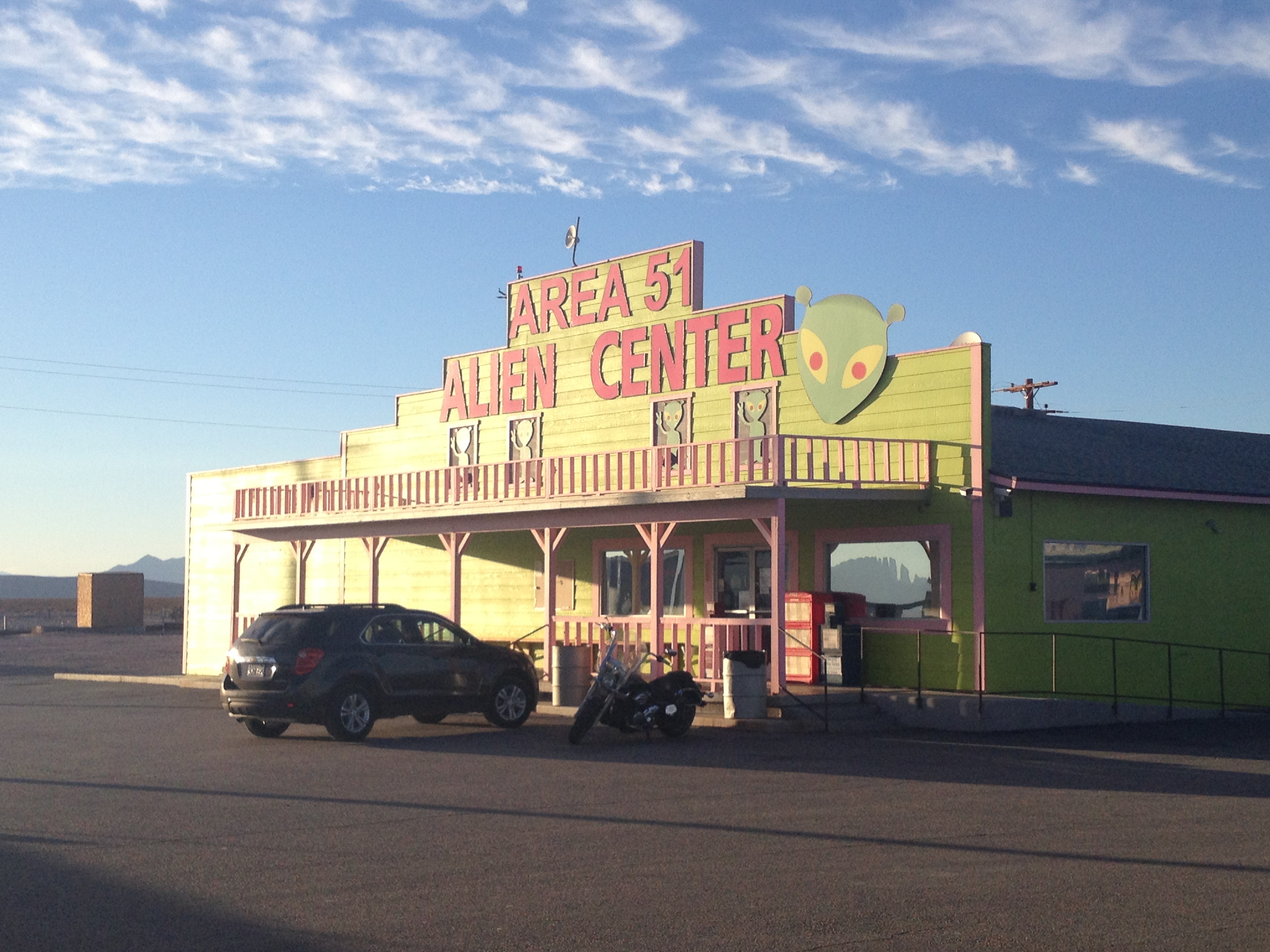
After we stopped awing at the vastness of the Grand Canyon, we continued on our road trip and crossed into another state…Nevada! We made a quick stop at Nevada Chicken Cafe in Las Vegas for lunch (one of Zak Bagans’ favorite restaurants so I had to go there) and then we continued for another 2 1/2 hours to our hotel in Death Valley National Park, California. (FYI this is Tuesday night of our trip and we traveled through five states in two days. We should have made a quick jaunt over to Four Corners to add New Mexico to the list!)
Welcome to Nevada
BUT you will have to remain on the edge of your seats for Part 3 to read about my adventures with Death Valley and the Sequoia trees in California.

Grand Canyon to Las Vegas to Death Valley


Amazing pics!
Thank you very much!
Love it! Love it! Love it! When are we going back. I had such a great time.
I can’t wait to go back and bring the whole family next time! 😉
Pingback: Heading West, Part 3: California | Wherever Life Takes Me