
There and Back Again


This month my mom and I took our new annual trip to Cannon Beach, Oregon and we ventured to some new places this year! One of them ended up being a failure, but hey “life is a journey, not a destination” right?? You have to make the most of what you have, and live in the moment. I had a wonderful vacation and am excited to share my adventures with you; expect beaches, lighthouses, snow and even a shipwreck!
We started off our trip on Friday by driving to Crater Lake from Portland. It’s about a 5 hour drive and we were all geared up and ready for it. Since we weren’t sure of the road conditions through the northern route (because we knew there was still snow at Crater Lake), we decided to go south all the way to Medford, OR and enter Crater Lake from that direction since we knew for sure that was an open route. By the way, at Medford we were probably about 30 minutes from the California border! That’s how far we drove! Practically the entire length of Oregon haha. Anyways, at Medford we finally saw signs for Crater Lake and began the 76 mile trek through Rogue River National Forest to Crater Lake National Park.
![IMG_2958[1]](https://whereverlifetakesme.com/wp-content/uploads/2013/04/img_29581.jpg)
Beautiful drive through Oregon on our way to Crater Lake
![IMG_2960[1]](https://whereverlifetakesme.com/wp-content/uploads/2013/04/img_29601.jpg)
We stopped along a bridge in Rogue River National Forest to take pictures of this view!
![IMG_2963[1]](https://whereverlifetakesme.com/wp-content/uploads/2013/04/img_29631.jpg)
This was taken about an hour before we reached Crater Lake…remember how the climate looks here….
![IMG_2973[1]](https://whereverlifetakesme.com/wp-content/uploads/2013/04/img_29731.jpg)
We are now in Crater Lake National Park and there is snow all around us!
![IMG_2974[1]](https://whereverlifetakesme.com/wp-content/uploads/2013/04/img_29741.jpg)
100% still winter here
![IMG_2972[1]](https://whereverlifetakesme.com/wp-content/uploads/2013/04/img_29721.jpg)
Almost to the rim of Crater Lake
![IMG_2970[1]](https://whereverlifetakesme.com/wp-content/uploads/2013/04/img_29701.jpg)
And…Crater Lake is supposed to be behind me!
![IMG_2969[1]](https://whereverlifetakesme.com/wp-content/uploads/2013/04/img_29691.jpg)
Behold, Crater Lake.

This is what I was supposed to see! (Thanks Steve for sending me your picture from Crater Lake lol!) Would have been a beautiful sight!
Though Crater Lake was a complete failure, at least the drive to and from there was gorgeous. Everything is so green and vibrant, and the sound of water flowing and rushing is nearly constant.
![IMG_2978[1]](https://whereverlifetakesme.com/wp-content/uploads/2013/04/img_29781.jpg)
A waterfall in Rogue River National Forest
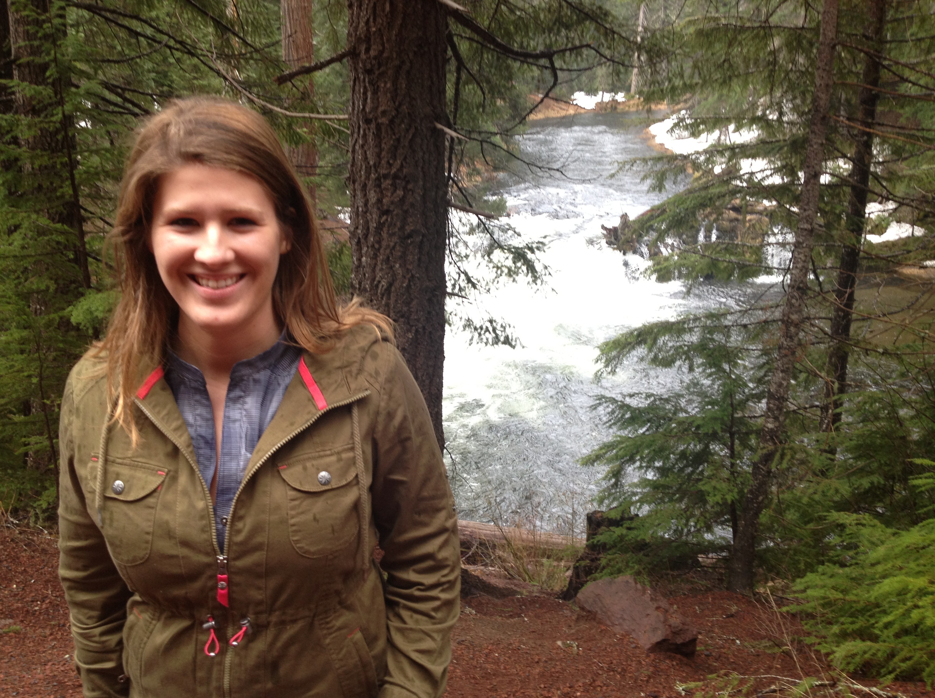
It’s amazing how different the climate is at the bottom.
![IMG_2981[1]](https://whereverlifetakesme.com/wp-content/uploads/2013/04/img_29811.jpg)
On our way back north, we made a stop at a lake we knew we could see – Diamond Lake.
![IMG_2982[1]](https://whereverlifetakesme.com/wp-content/uploads/2013/04/img_29821.jpg)
The lake was mostly frozen still.
![IMG_2985[1]](https://whereverlifetakesme.com/wp-content/uploads/2013/04/img_29851.jpg)
Though we were at much lower elevation than Crater Lake, it’s still winter in this part of Oregon!
![IMG_2986[1]](https://whereverlifetakesme.com/wp-content/uploads/2013/04/img_29861.jpg)
I think this is the first time I’ve seen a frozen lake…at least of this size!
![IMG_2987[1]](https://whereverlifetakesme.com/wp-content/uploads/2013/04/img_29871.jpg)
Gorgeous lake view!

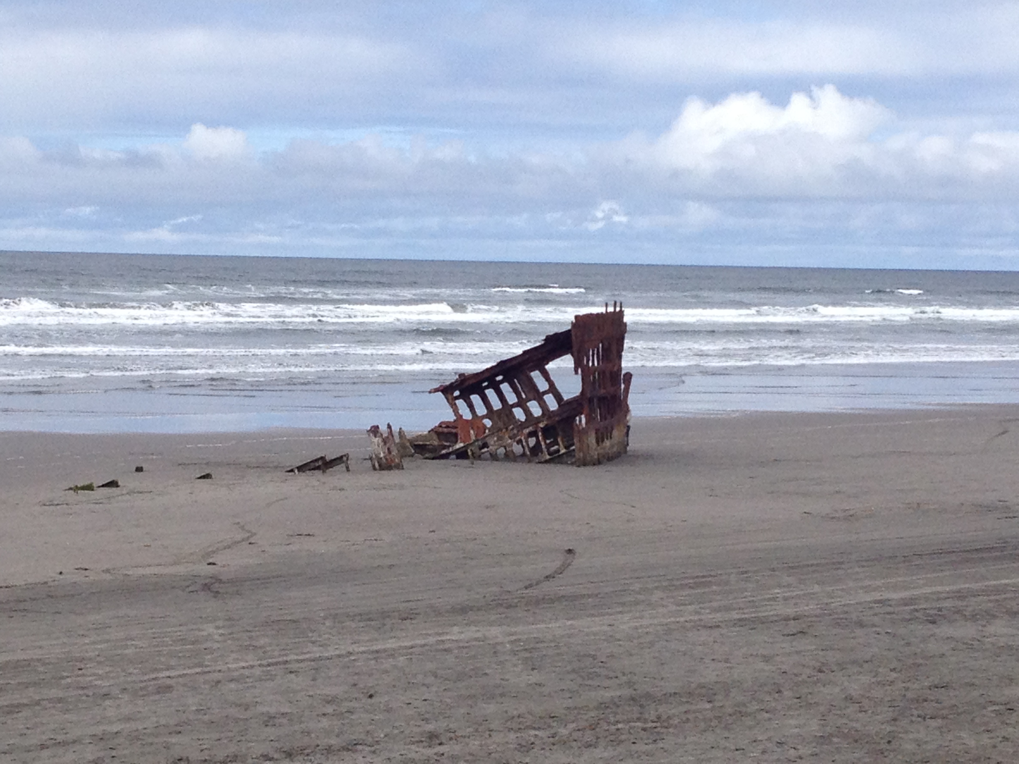
Me with Peter Iredale
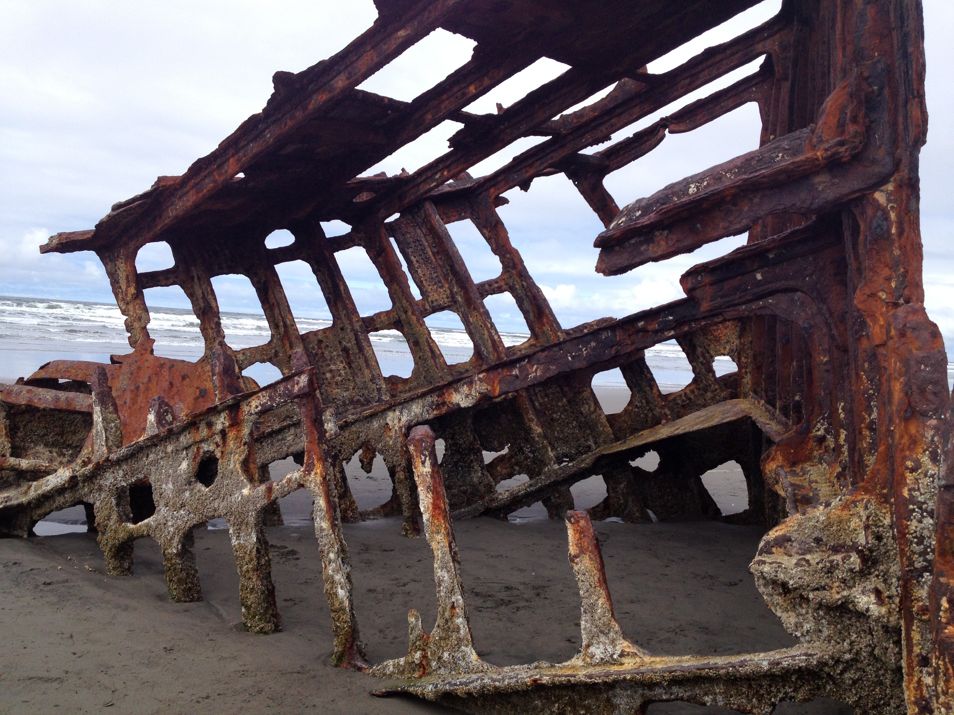
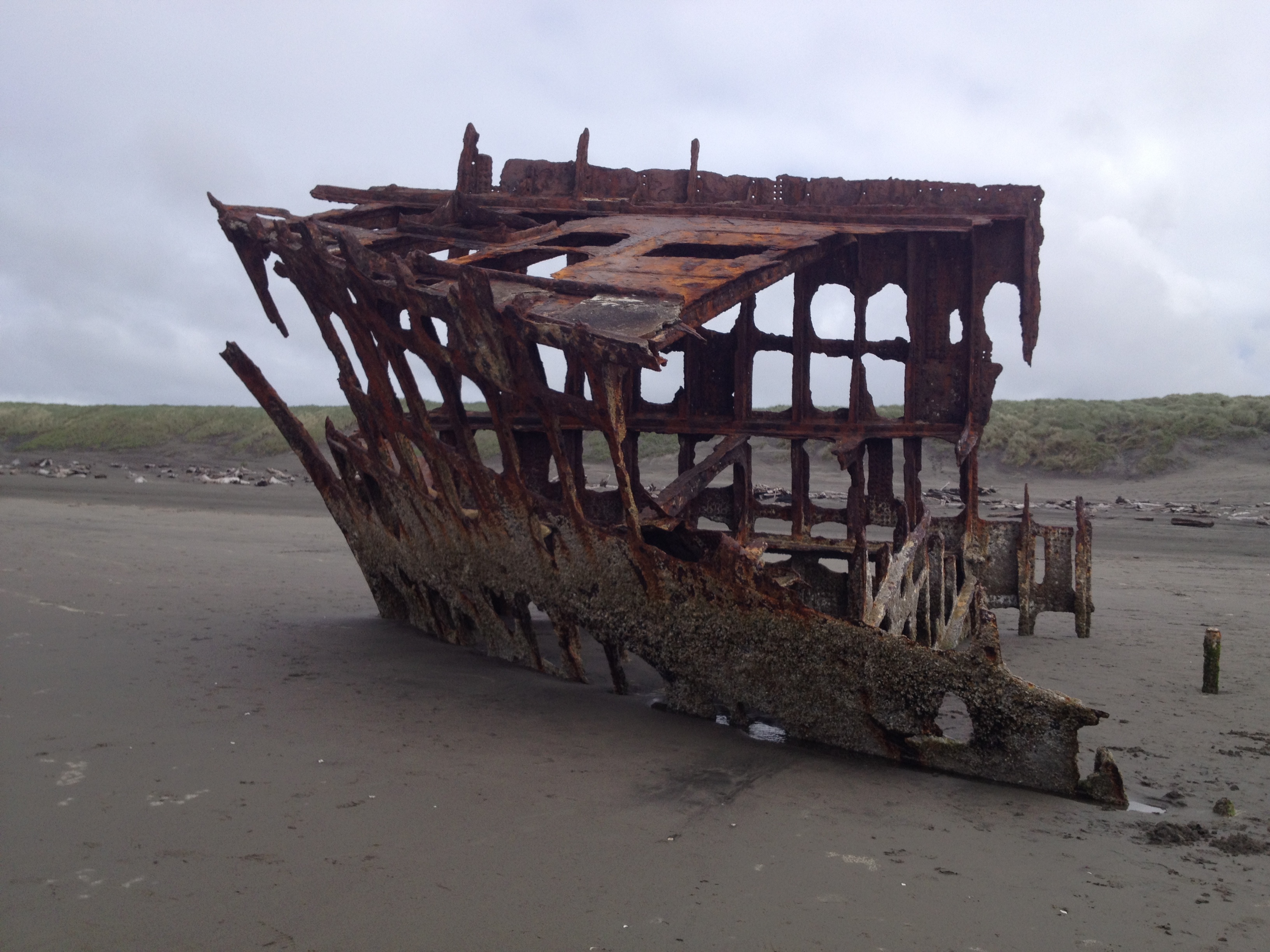
The Peter Iredale is the most accessible of the many shipwrecks along the Pacific Northwest coast. The stretch of coast from Tillamook Bay in Oregon and up north to Cape Scott Provincial Park on Vancouver Island is known as the Graveyard of the Pacific for the thousands of wrecked ships beginning with European exploration in the 15th century. This coastal region is prone to unpredictable weather and heavy storms. And combine that with the rugged and rocky coastline and it’s a magnet for unsuccessful voyages and crashes.
In the fall of 1906, the Peter Iredale was bound for Portland from Mexico to pick up a cargo of wheat for England, and most of the voyage went smoothly until the ship neared the coast of Oregon. The crew had managed to safely enter the mouth of the Columbia River but then strong winds and currents forced the ship aground at Clatsop Beach and snapped off three of the masts in the impact. None of the crew were seriously injured and were soon rescued by a team stationed at Point Adams. Immediately the shipwreck became a tourist attract, and, although most of the ship has deteriorated over the years, the Peter Iredale continues to be a popular tourist attraction on the shores of northwestern Oregon.

This is a picture of the shipwreck shortly after it occurred.

The Peter Iredale
When it was determined the ship could not be saved, usable parts were salvaged and sold, leaving just the frame intact along the beach.
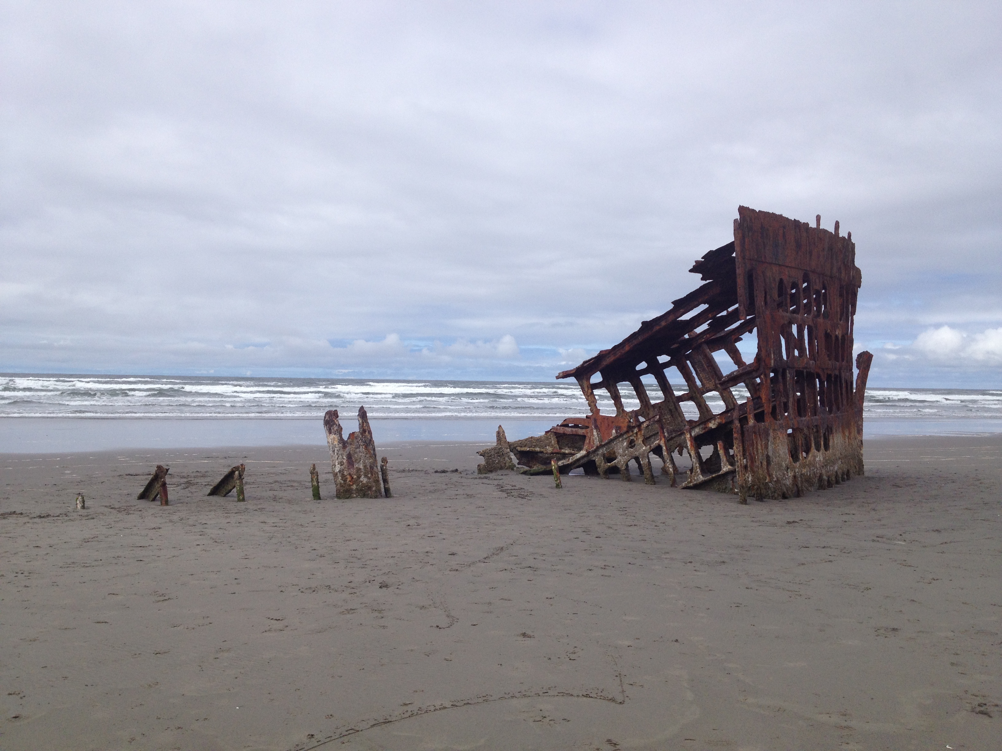
It’s incredible how much deterioration from the water, wind and sand has occurred in just 100 years.

The Peter Iredale is perched so close to the water…it makes for a cool photo opp.

The ship was built in England in June of 1890, and was last commanded by Captain H. Lawrence when the ship ran ashore on October 25, 1906 and was thus abandoned.

“A lifeboat was dispatched from Hammond, Oregon and assisted in evacuating the sailors, who were tended to at Fort Stevens. No casualties occurred in the accident.”
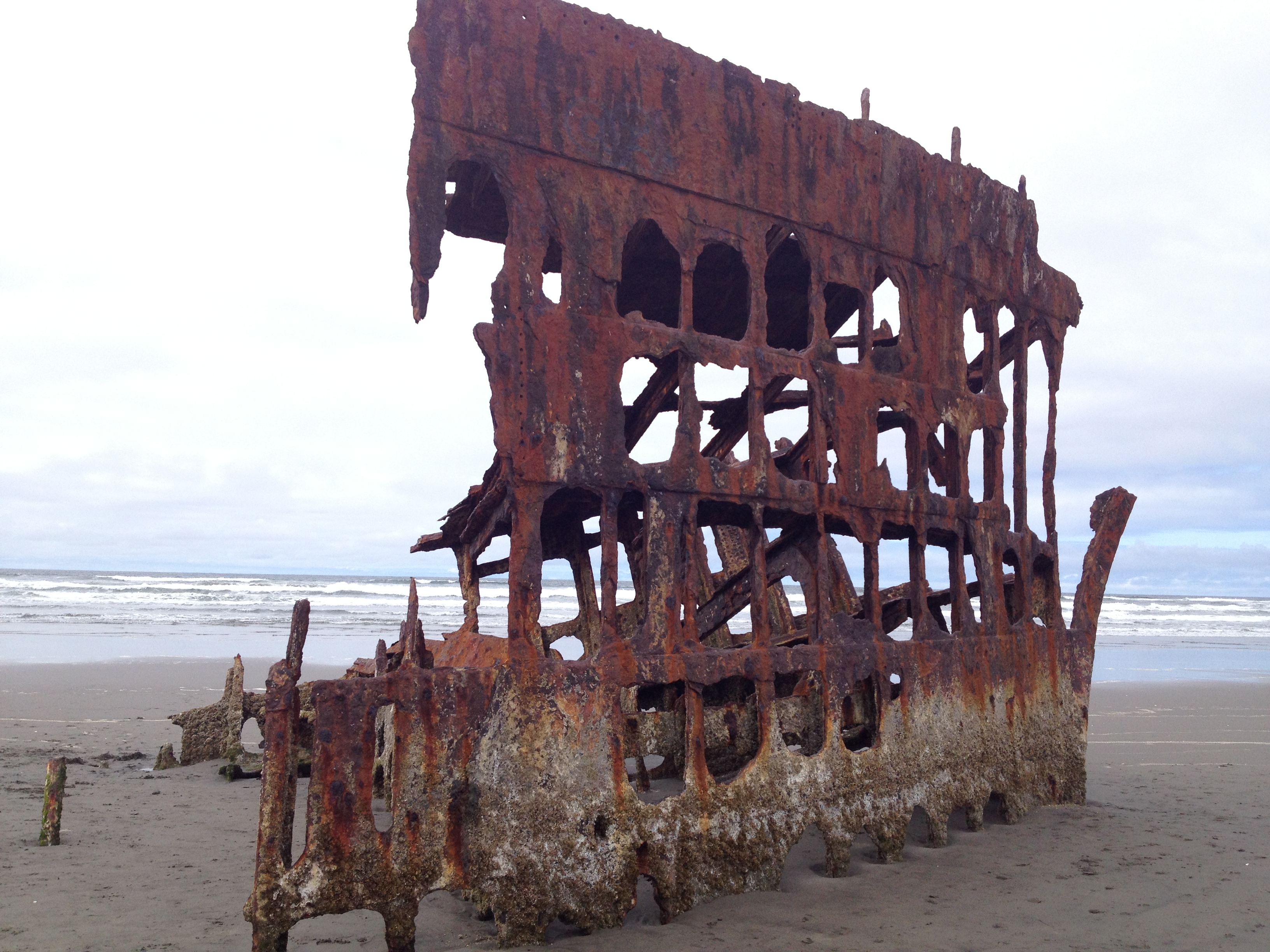
“Captain Lawrence’s final toast to his ship was: ‘May God bless you, and may your bones bleach in the sands.'”
It may not be much longer until Captain Lawrence’s toast comes true, and the ship’s bones completely fade into the sand.
“A Naval Court inquiry was held in Astoria on November 12 and 13, 1906, by the British Vice-Consulate to determine the cause of the wreck. After investigating, no blame was placed on Lawrence and the crew for the loss, and he and his officers were commended for their attempts to save the ship.”

The rudder of the ship sits in the parking lot at the Columbia River Maritime Museum in Astoria.

No one was around when I explored which was nice. 🙂
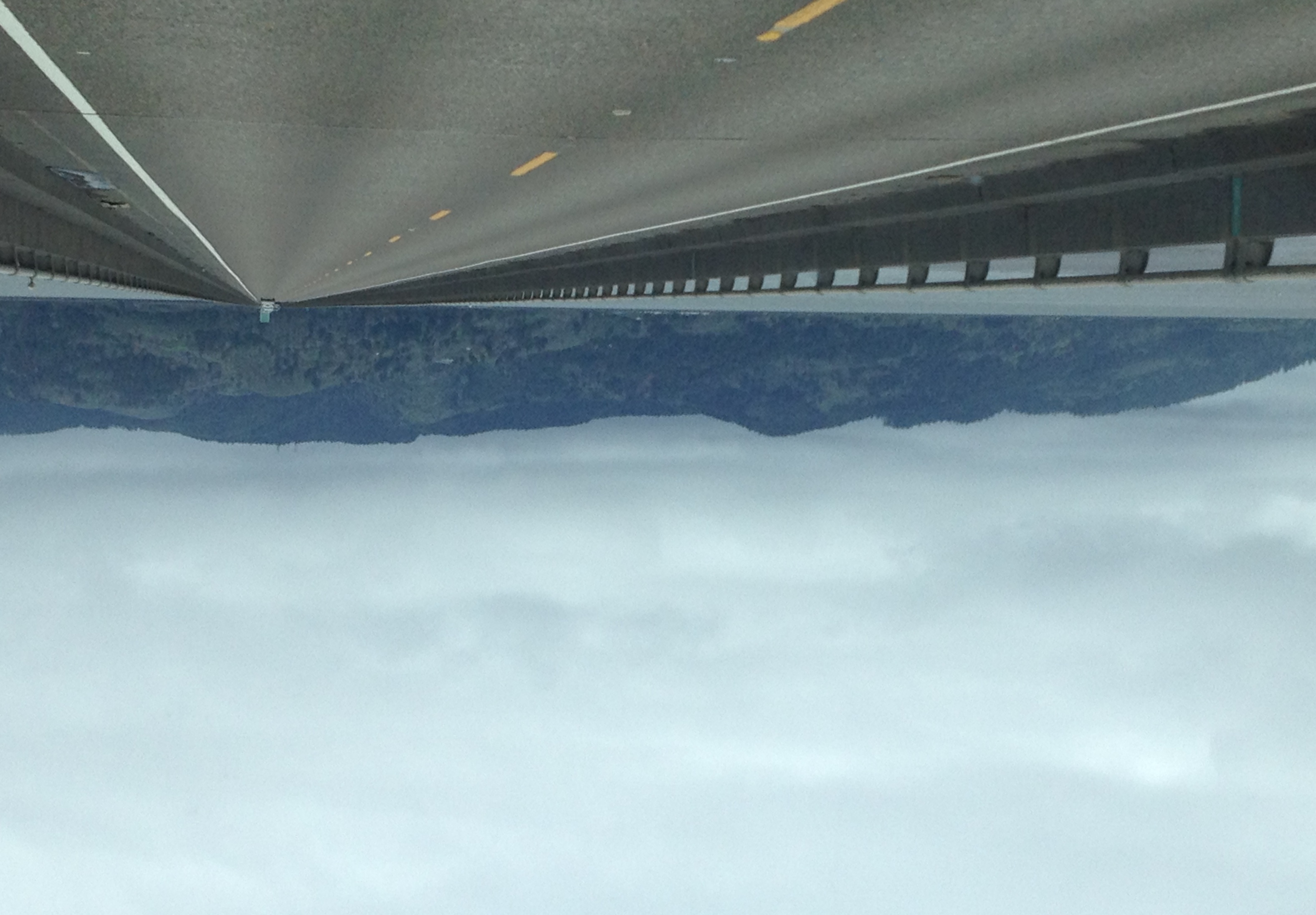
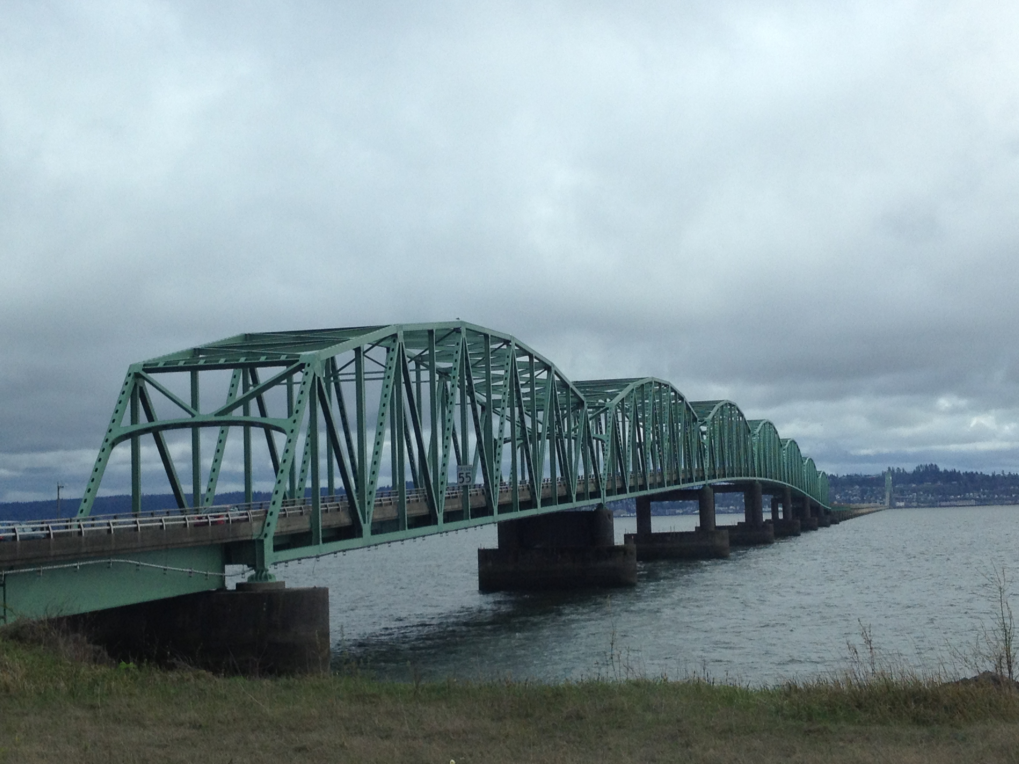
After exploring the shipwreck, we hopped back onto Highway 101 and continued north to Astoria. In Astoria we took the long bridge, over 4 miles long, into the state of Washington. We drove along Washington’s coast to our destination, Seaview. We grabbed yummy seafood at The Crab Pot, and then ventured into some great antique stores. We were successful and found several cool nautical items we would not find in Missouri. Mom and I both bought old ship lanterns and antique glass fishing floats. While in Seaview, we also found the place where I first saw the Pacific Coast when I was three years old on a family vacation. We drove along the beach just like we had 21 years ago. It’s pretty cool that the state allows vehicles on the beach. A fun experience!

Taking the bridge in Astoria into Washington State.
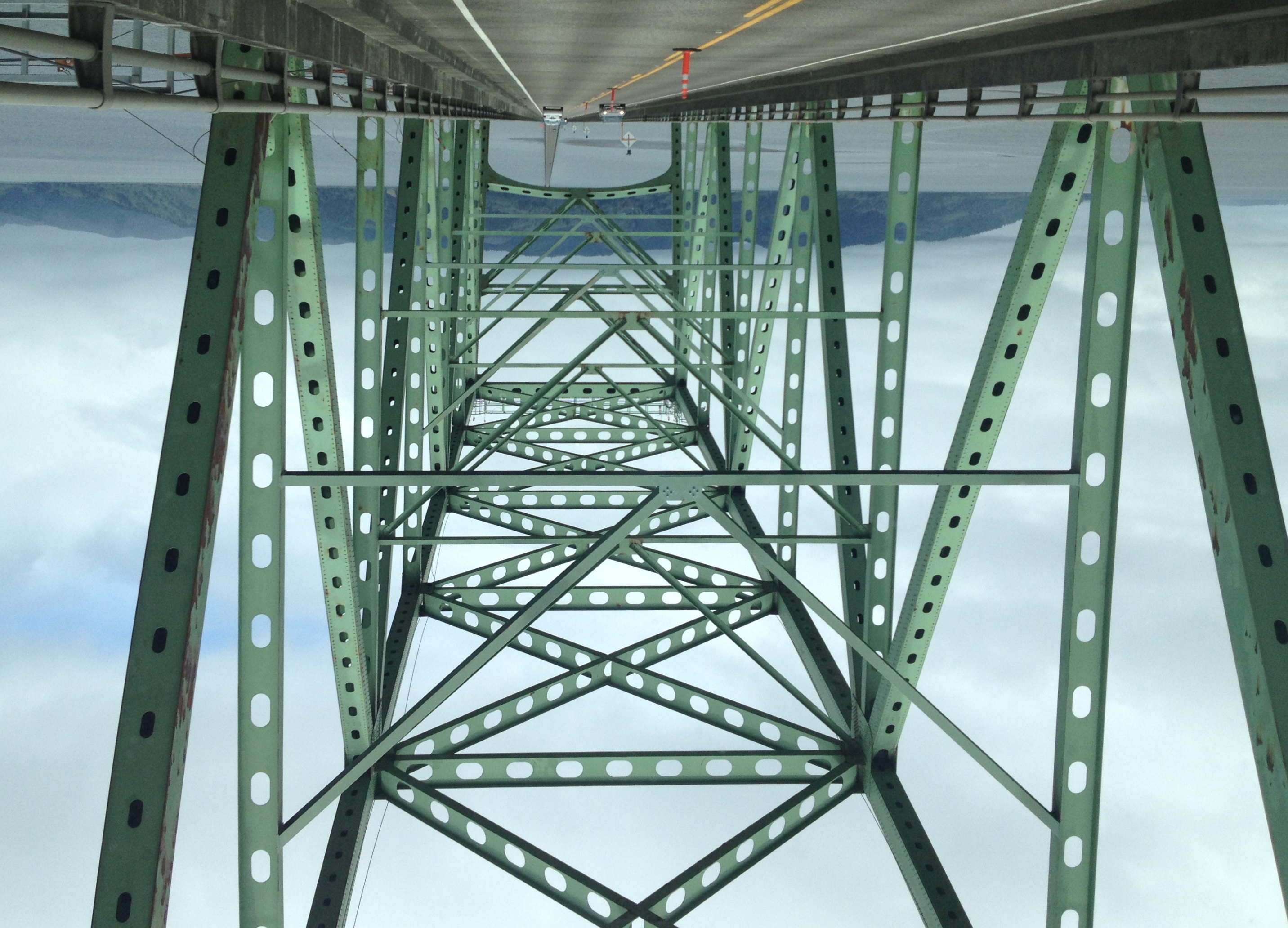
The Astoria–Megler Bridge is 4.1 miles long, and is the longest continuous truss bridge in North America
The bridge was the last completed segment of Highway 101 between Olympia, Washington, and Los Angeles, California.

An old church along the highway in Washington.
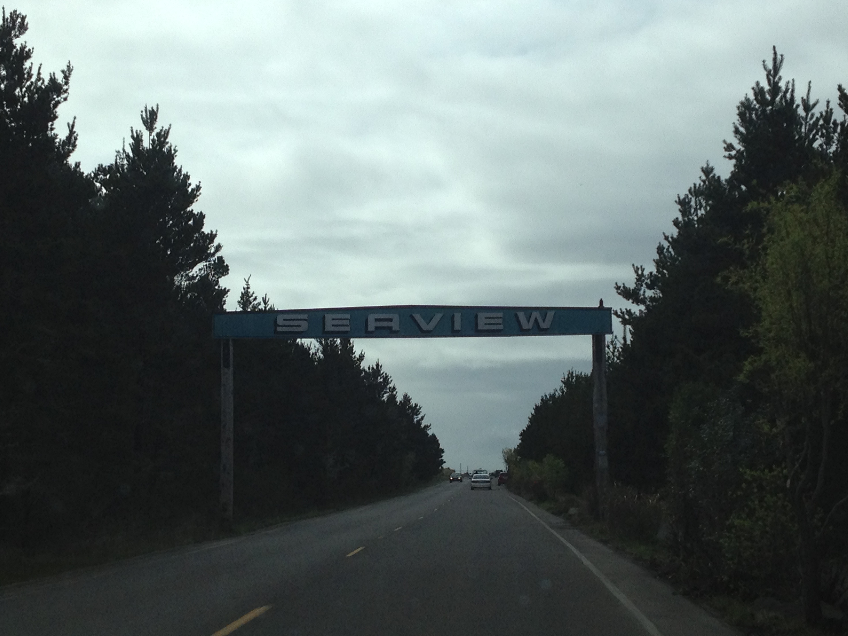
Seaview, Washington
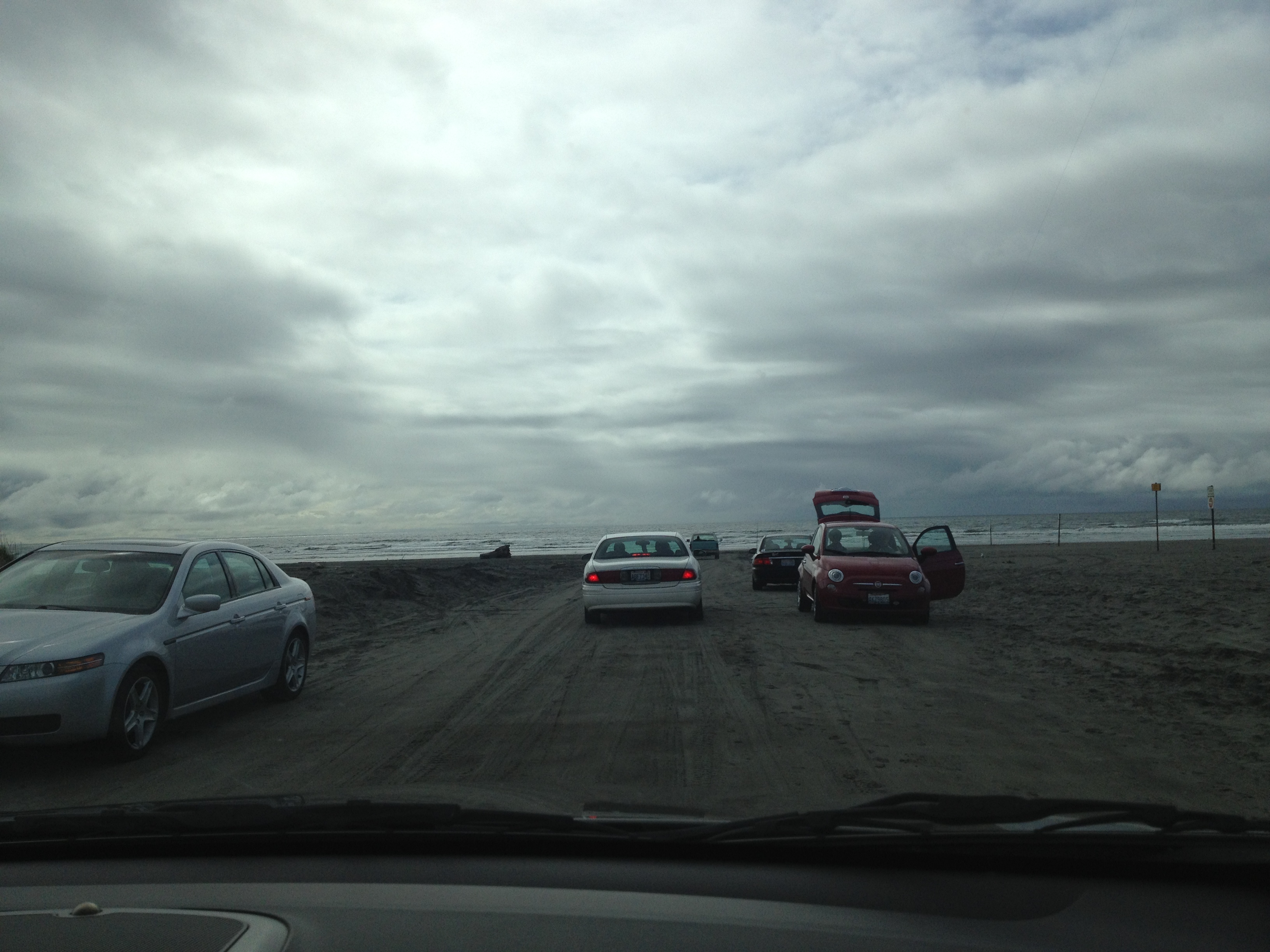
You can drive your cars on the beach here!
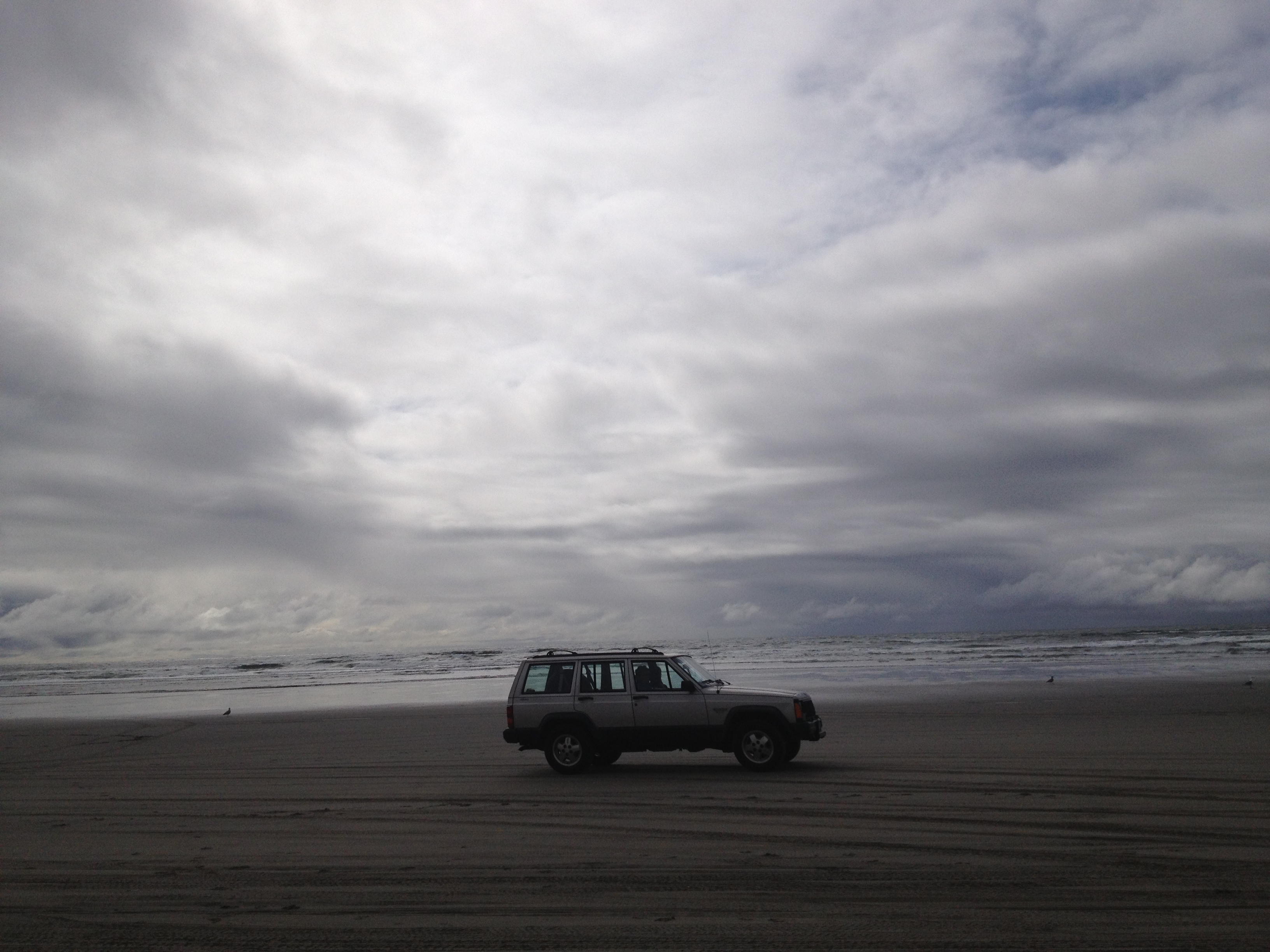
Just cruising on the beach!
This is the same spot my family visited when I was 3 years old and I can still vaguely remember. It’s probably one of my earliest memories.

This beach coastline of Washington is very wide, which may be a reason why cars are allowed.

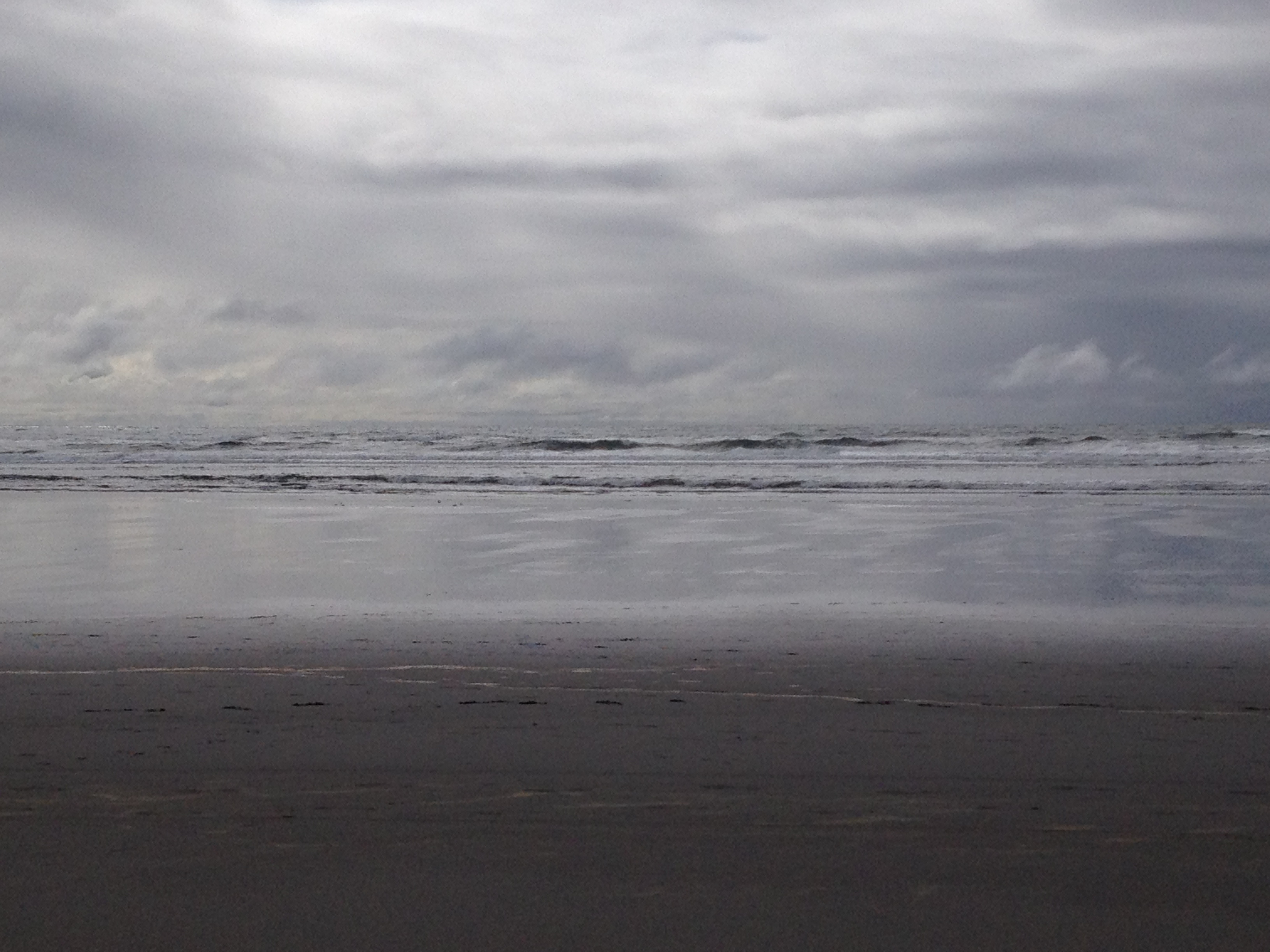
The sun is coming out!

Goodbye, Seaview.
On our drive back down the coast towards Oregon, we detoured at Cape Disappointment State Park on the Long Beach Peninsula in Washington. This state park offers hikes to two lighthouses plus numerous other trails and miles of ocean beach. Our first stop in the park was North Head Lighthouse. It was a 1/4 mile walk to the lighthouse through a beautiful forest canopying the trail that then opened up into a breathtaking view of the Pacific Ocean. North Head Lighthouse was constructed in 1898 as the primary navigation aid at the mouth of the Columbia River. The Cape Disappointment lighthouse was built in 1856 (and is still the oldest functioning lighthouse on the West Coast), but ships continued to wreck in the “Graveyard of the Pacific” and it was decided a second lighthouse was needed to assist with navigating the perilous river bar.

Hiking to the lighthouse

North Head Lighthouse

I think this is my first lighthouse visit!

View of the ocean from the lighthouse

Today, the North Head Lighthouse continues to provide aid with an automated beacon to help navigate the treacherous confluence between the Columbia River and the Pacific Ocean.

Tours of the lighthouse are offered from May through September.

The lighthouse keepers lived in a house about 1/2 mile from the lighthouse. It is also open for tours during the summer.

Amazing view of the coastline!
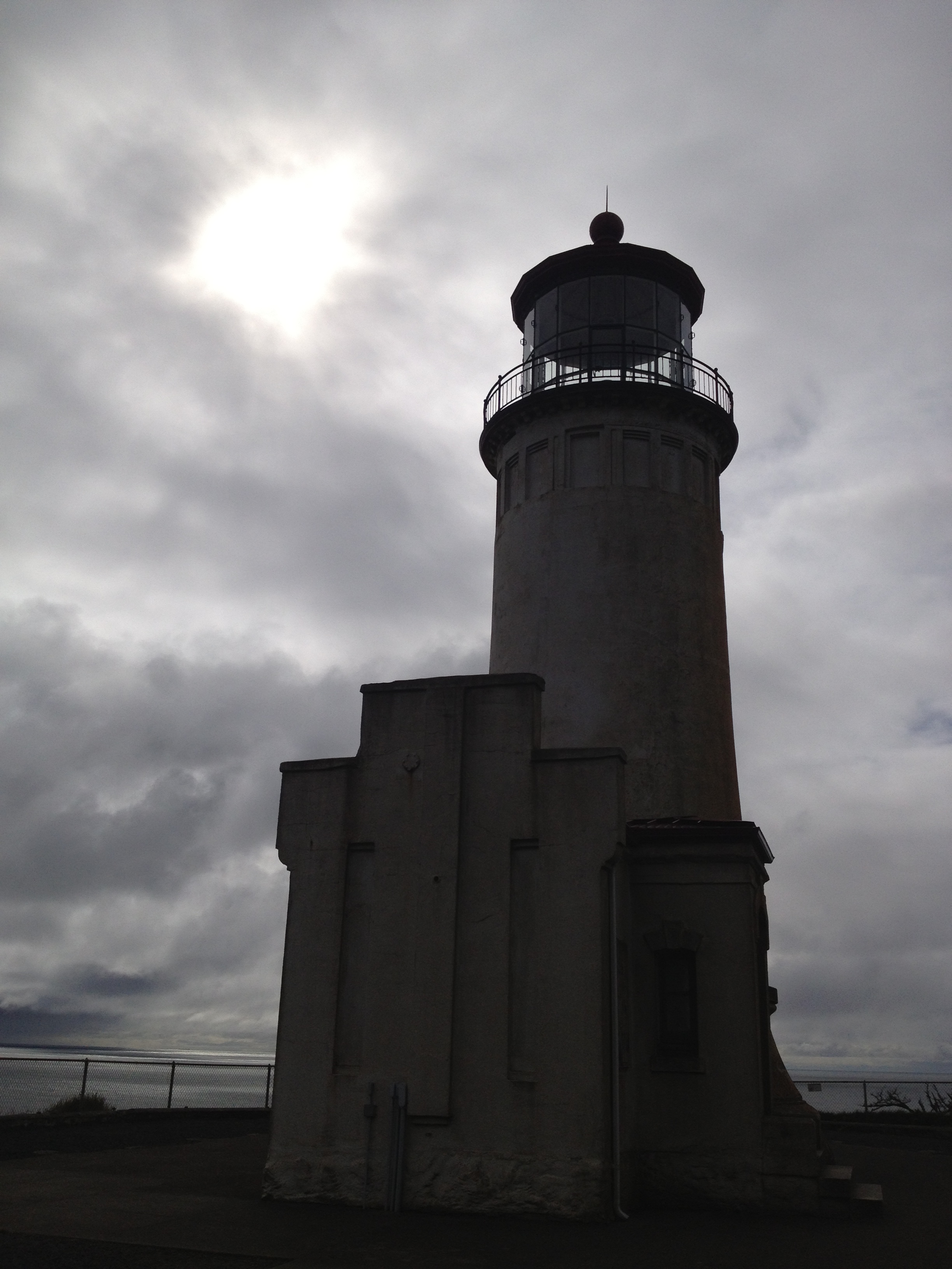
This lighthouse still helps sailors navigate the treacherous waters of the “Graveyard of the Pacific”.

North Head

Side comment: I swear Oregon has more National/State Parks than most states haha. You are constantly in one.
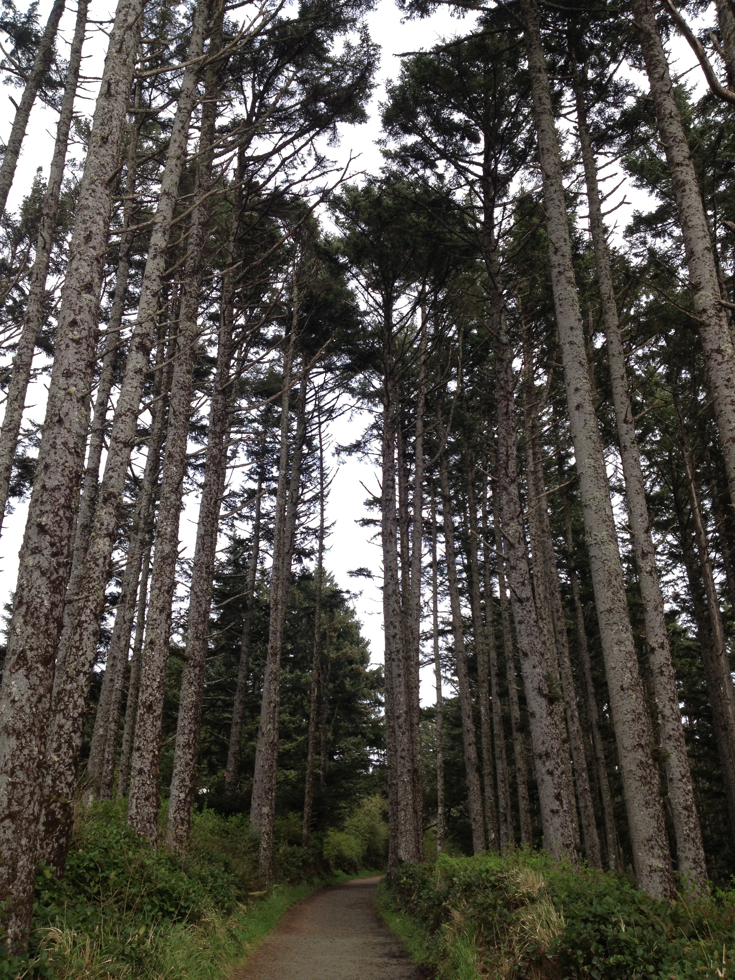
If it was a nicer day we might have hiked more in the beautiful forests!
We ended up not hiking to Cape Disappointment Lighthouse due to the rain and it was a mile long hike. Not that that amount is strenuous but we were ready to get back to Cannon Beach and relax. I will have to save my adventure to Cape Disappointment Lighthouse for another trip.
Taking the bridge back into Oregon

Goodbye, Washington

Astoria, Oregon
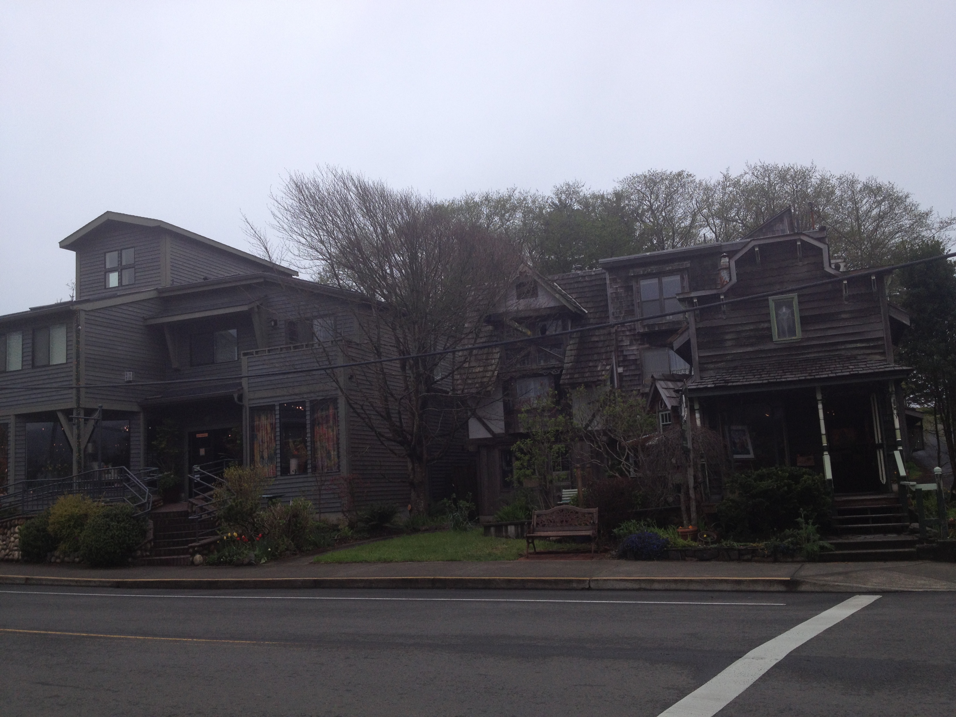
To conclude our busy Saturday, we had dinner at our local favorite, Sweet Basil’s in Cannon Beach. Then on Sunday, guess what? It was still cloudy. The sun was not ready to come out…so another drizzly morning in the Pacific Northwest. To be expected. So instead of walking on the beach, we hit up the local shops in Cannon Beach. Mom bought some amazing hand-blown glass pieces from Icefire Glassworks, and I assisted in their drawing for a glass artwork.
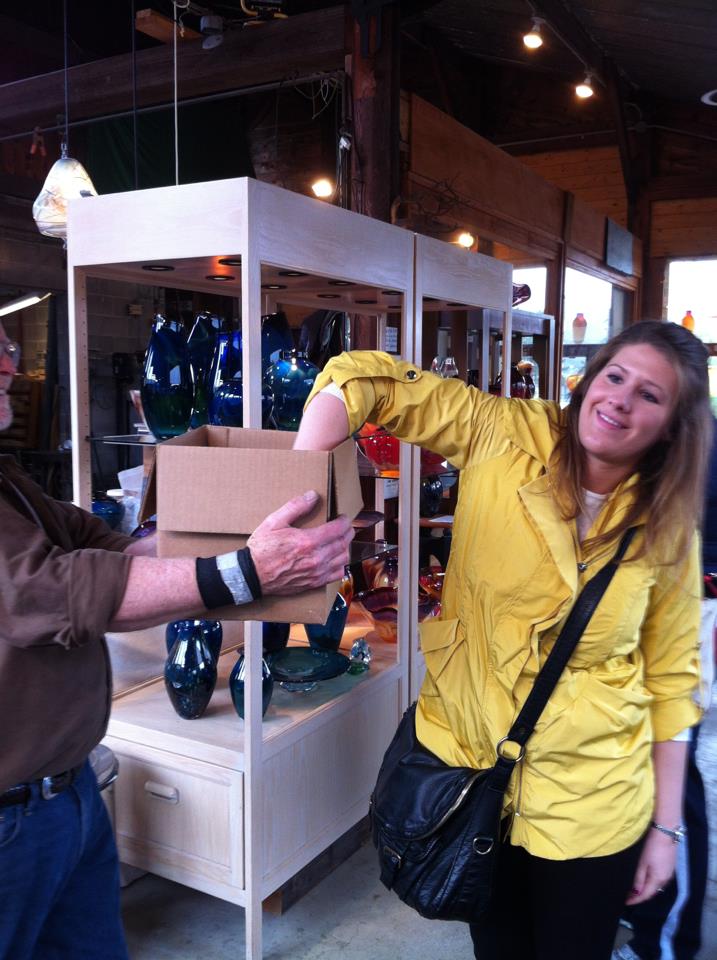
If I had known my picture was being taken I would have had better posture lol.
Next, we dined at The Wayfarer for lunch with a wonderful view of Haystack Rock. By late afternoon the sun started to come out, but we had dinner reservations to attend. We ate an amazing four-course dinner at The Stephanie Inn and it was just next door to our own hotel, The Ocean Lodge. 🙂
Another overcast day in the Pacific Northwest
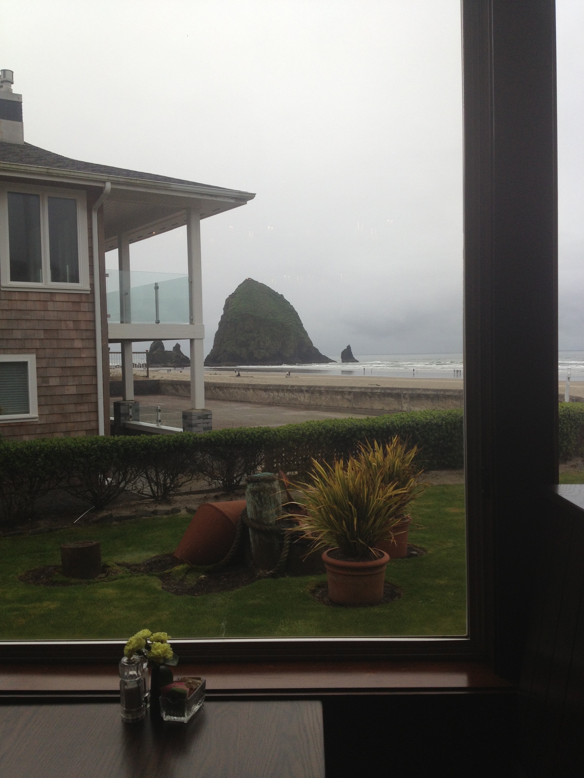
Our view during lunch at The Wayfarer.

Haystack Rock

The sun started to come out by late afternoon.

Though I prefer the sun to be shining, clouds make for pretty pictures. 🙂
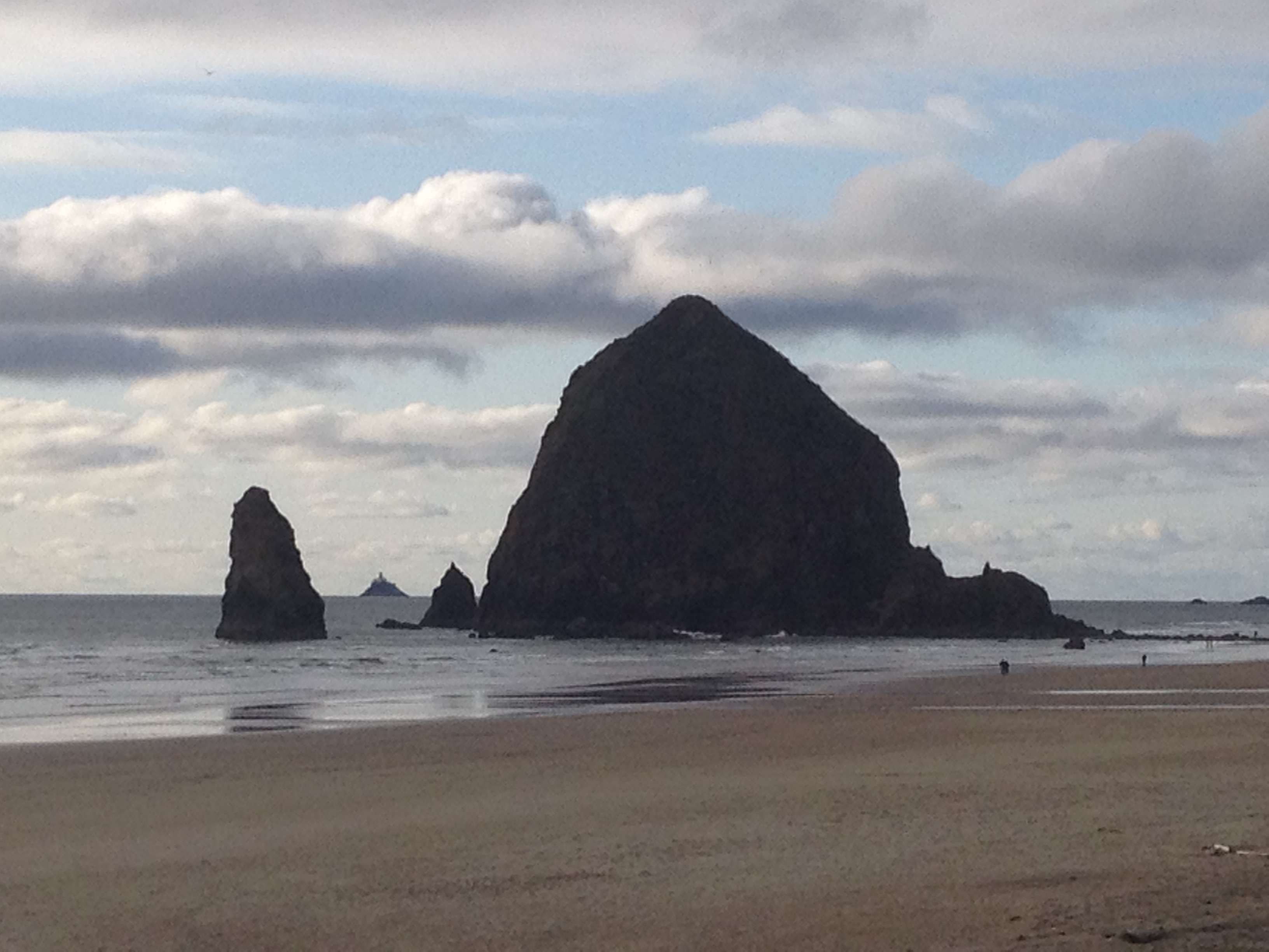
Haystack Rock
On Monday we finally got our walks along the beach in Cannon Beach because the sun decided to show itself! Yay!

Beach day!
The first recorded journey to the area now known as Cannon Beach was documented by William Clark in 1806. Yes, that William Clark of Lewis and Clark fame. The Lewis and Clark Expedidition was residing at Fort Clatsop, about 20 miles north of Cannon Beach. Clark and his team visited the area to find a whale that had washed shore, and he named the local creek in the area “Ekoli” meaning “whale” in Chinook. The creek later became known as Ecola. From an overlook in what is now Ecola State Park, Clark described the region of Cannon Beach as “…the grandest and most pleasing prospects which my eyes ever surveyed, in front of a boundless Ocean…” That viewpoint became known as “Clark’s Point of View” and is marked on a hiking trail from Indian Beach in Ecola State Park. I believe I stood in this area on our trip last year. And it is a grand and pleasing view indeed, Mr. Clark!
Early settlers called the area, Elk Creek, a derivation from Clark’s original name of the local creek. But in 1846, a cannon from the shipwrecked USS Shark washed ashore and thus the name Cannon Beach was born. In 1922, the city officially adopted Cannon Beach as it’s name. The original cannon is on display at the Cannon Beach History Center and a replica is located at the north entrance on Highway 101.

Cannon Beach hosts an annual sand castle contest in June. I bet that is fun to attend!

View of Ecola State Park in the distance.

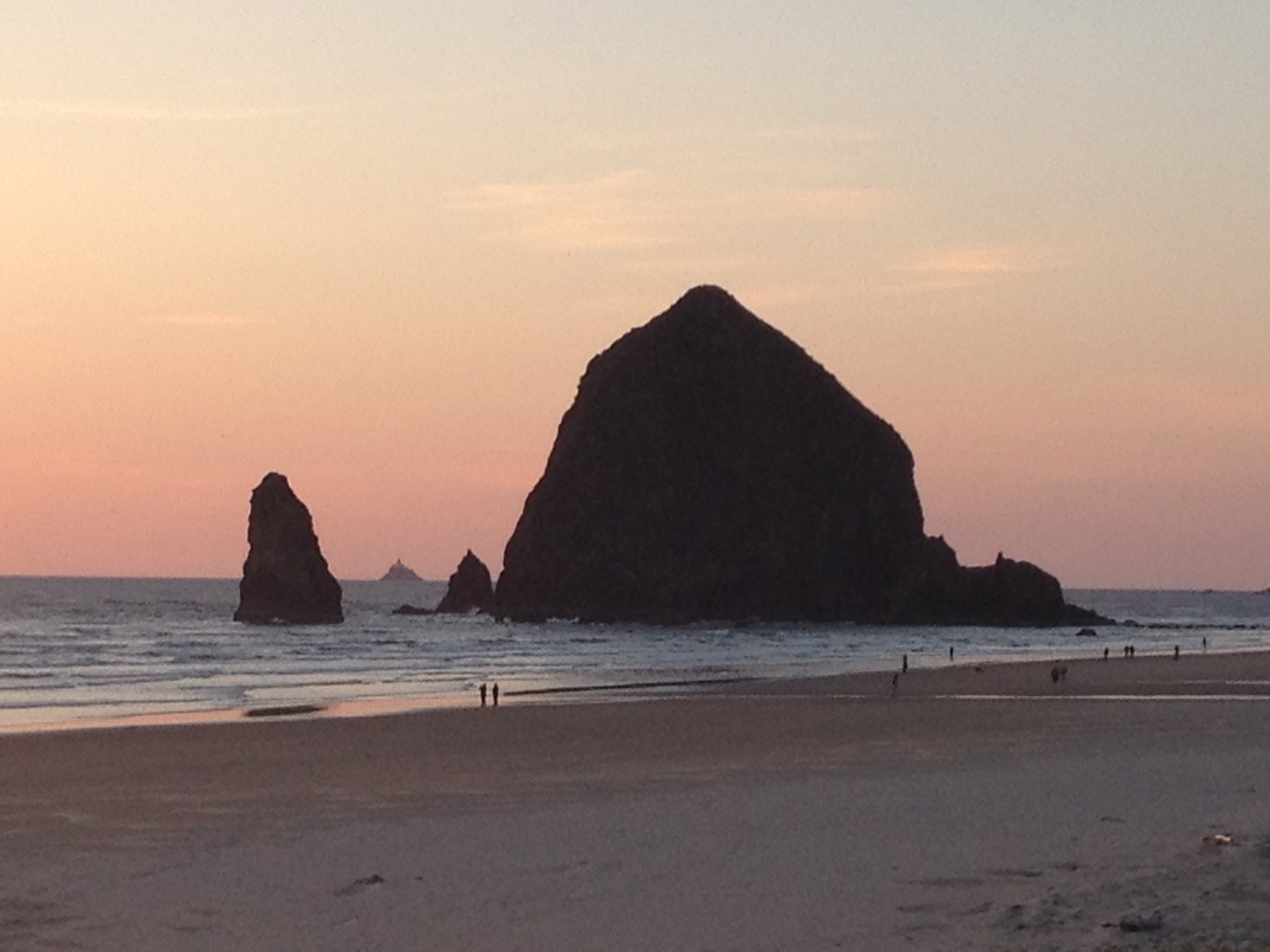
Cannon Beach is recognized by its well-known landmark, Haystack Rock.

The rock stands at 235 feet and was most notably used as a location in The Goonies.

Me and my favorite rock!

The isolate Tillamoook Lighthouse

Perfect windy day for kite flying!

Our hotel – The Ocean Lodge. Amazing place to stay!
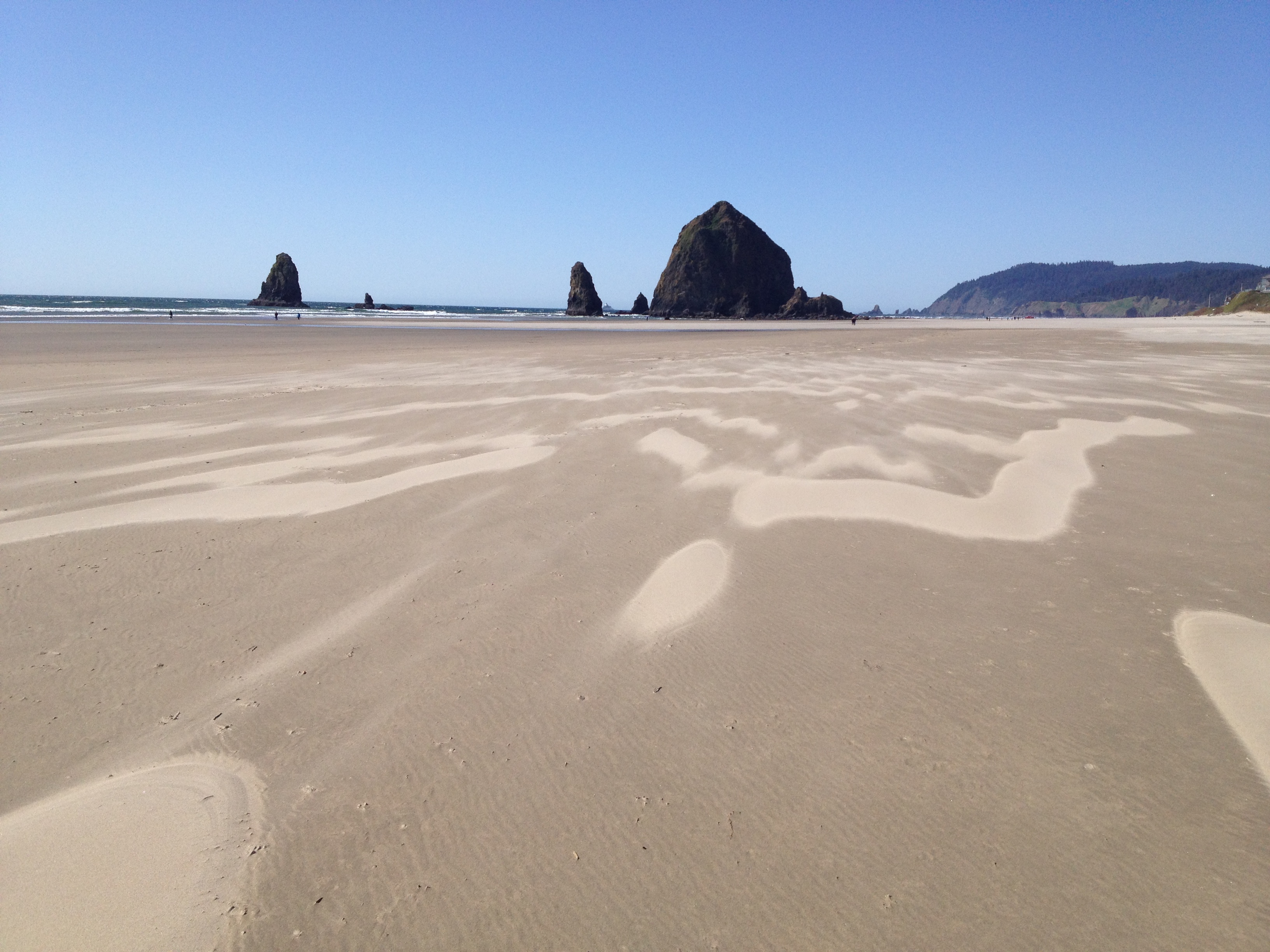
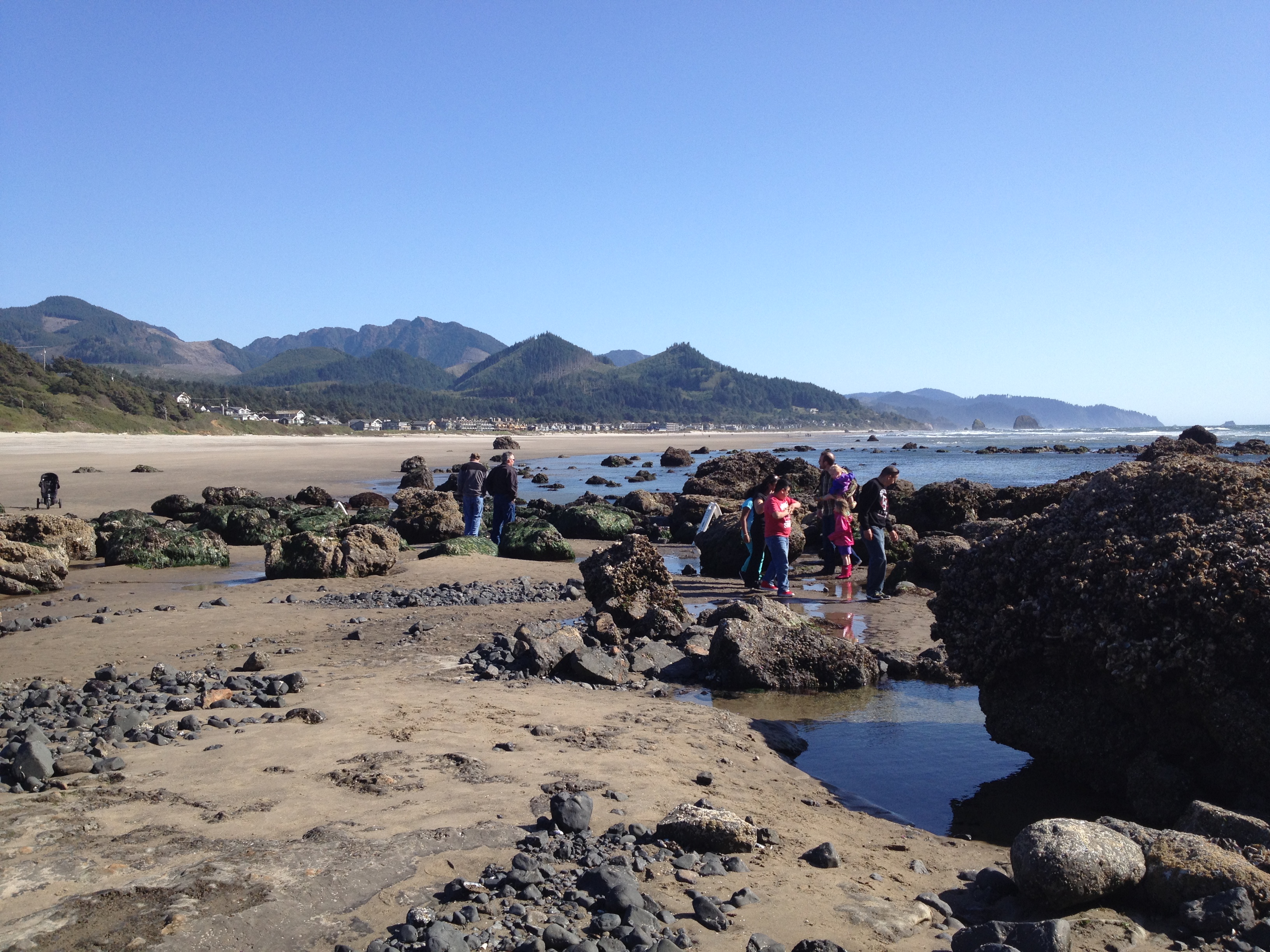
Mom and I walked back to Haystack Rock at low tide, and it was really windy!! The sand was sweeping across in a cool way.

Did I mention it was windy?
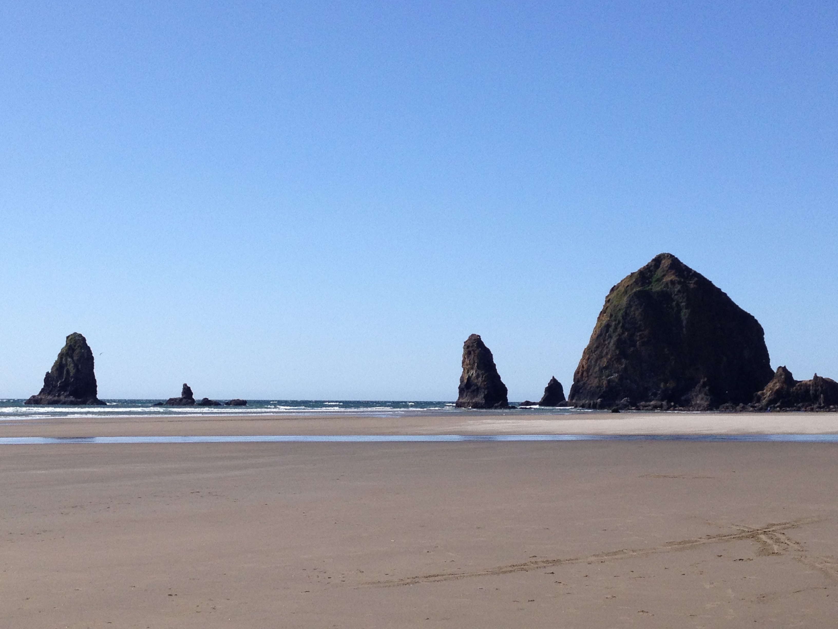
Haystack rock is often accessible at low tide and tourists can walk up to the rock under the supervision of the Oregon Island National Wildlife Refuge.

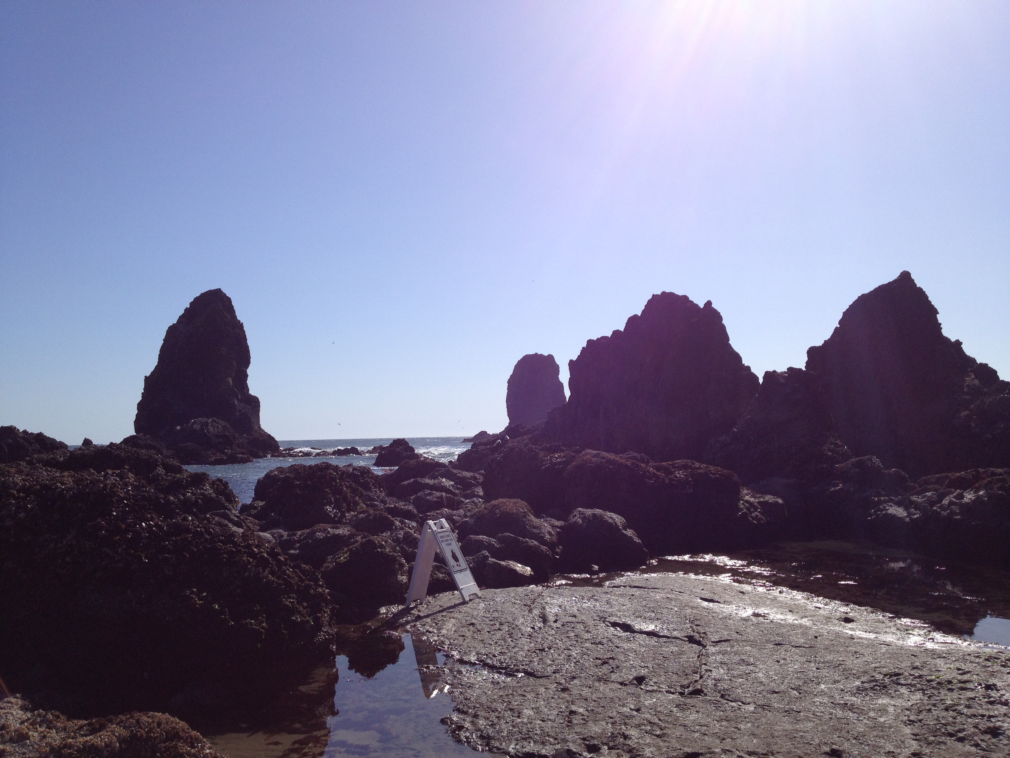
These rocks are called The Needles.

Haystack Rock at low tide.
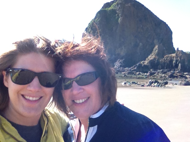
Mom and I
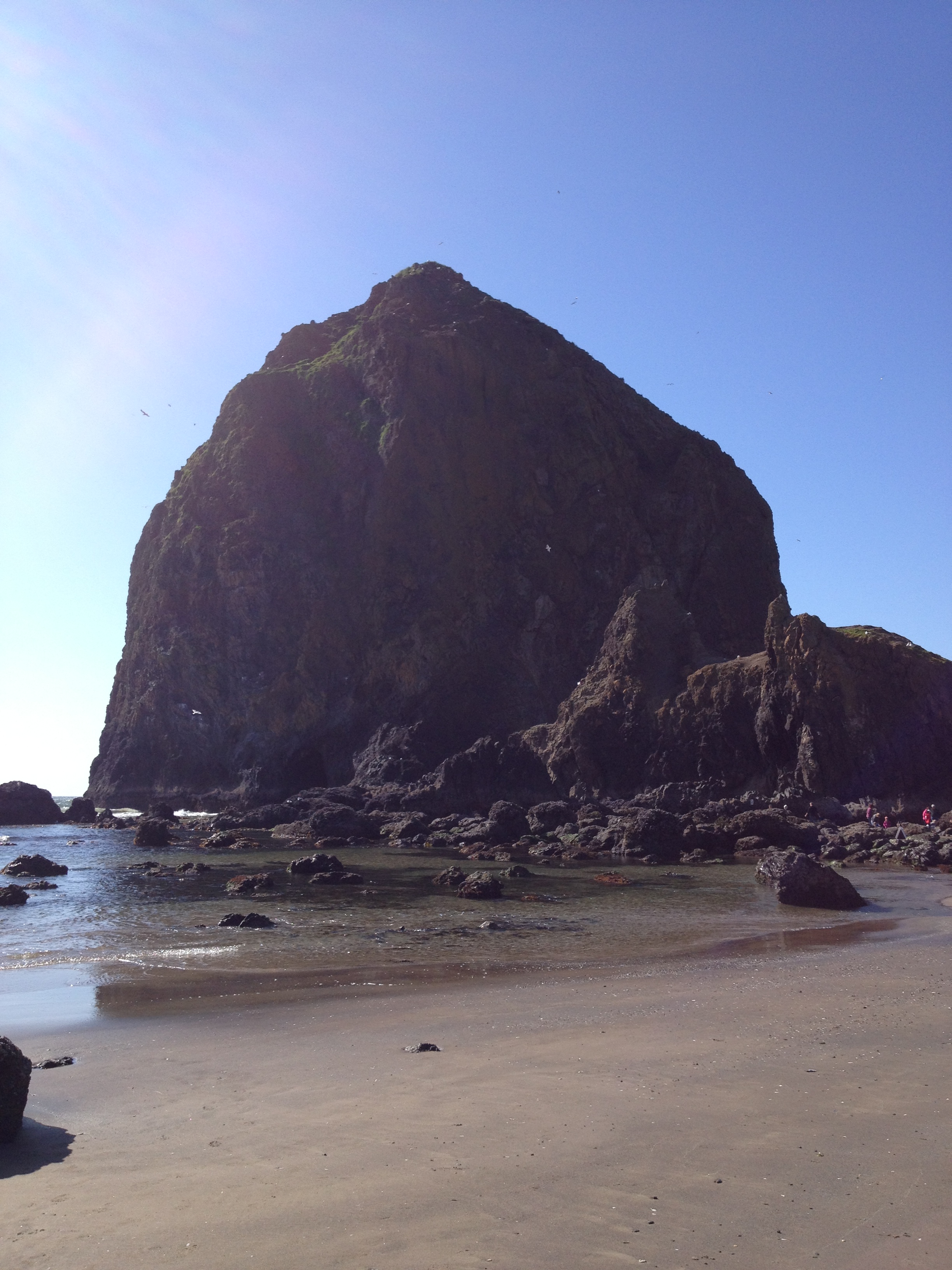
A small cave system penetrates Haystack Rock and is visible from the coastline. Do you think there’s pirates treasure hidden in the cave??

Beautiful weather!
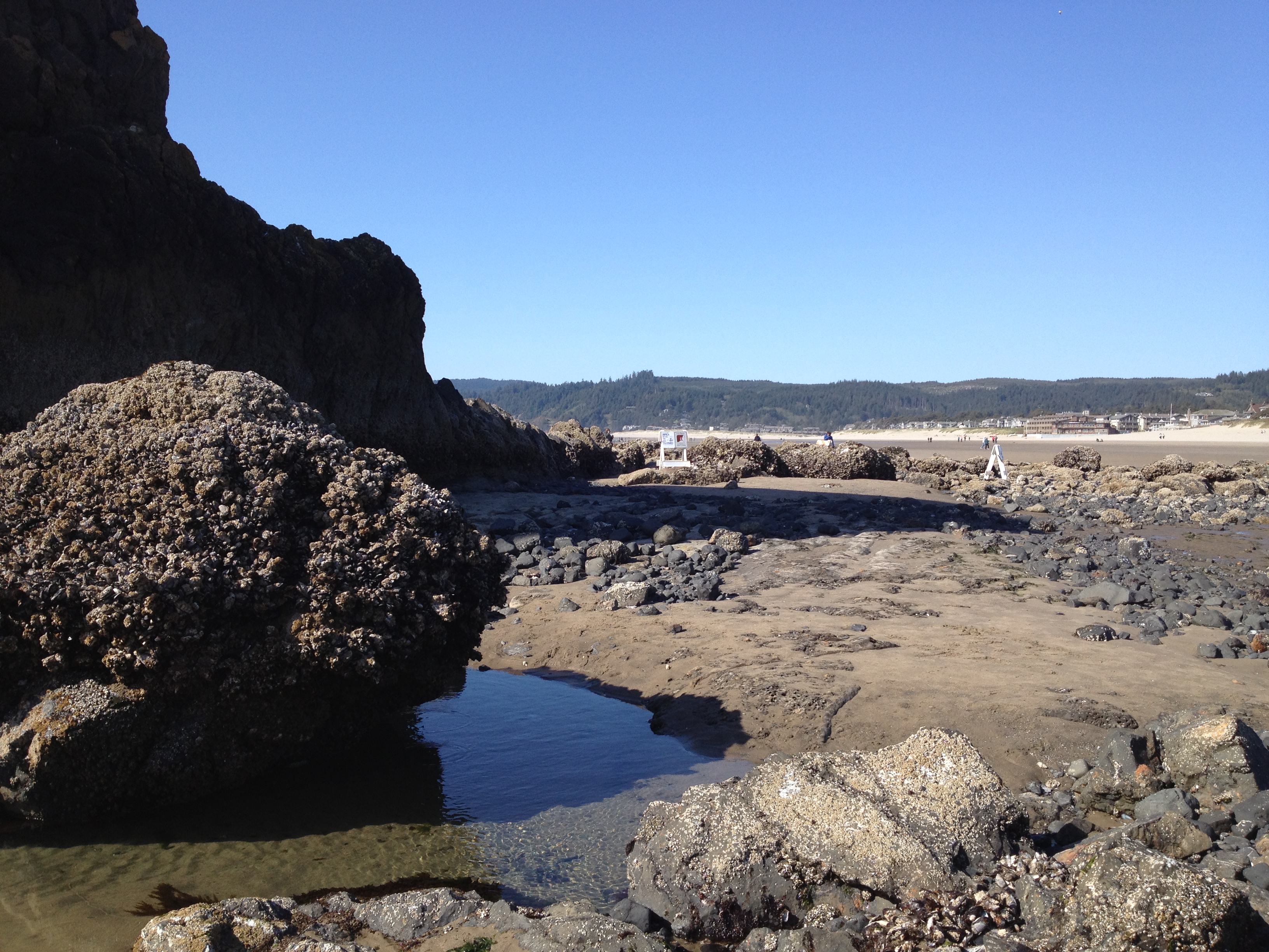
Most of the time this area is underwater.
Lots of sealife is visible at low tide, such as starfish.
The Haystack Rock Awareness Program stafff our out during each low tide to montior and be available to answer questions about the region and its wildlife.

Haystack Rock is protected as a marine sanctuary, and events are not allowed within 100 feet of either side of the rock.
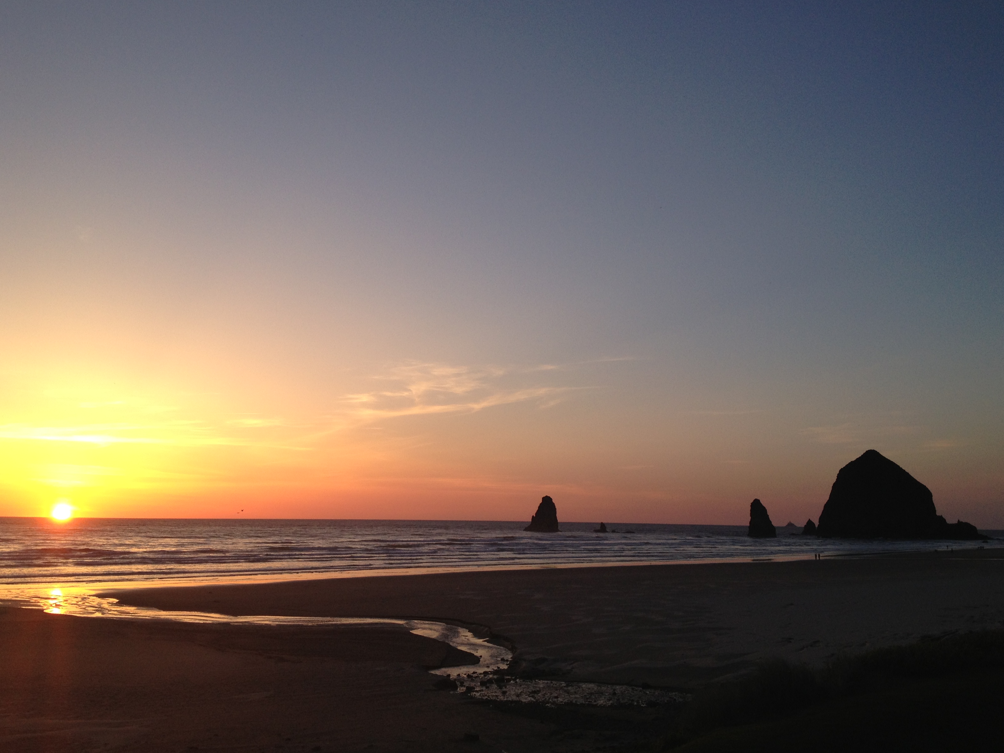
We got back from dinner just in time to see the sun dropping below the horizon!

Beautiful sunset!
The tide is back up as the sun sets.

Goodbye, Cannon Beach.
Thanks for reading and hopefully you enjoyed my trip to Oregon with me! Cannon Beach is a truly charming and gorgeous area of the Pacific Northwest and I highly recommend a vacation there!
If you are curious about what I did last year on my vacation in Cannon Beach click here.


Ernie and I like Haystack too. Such beautiful country